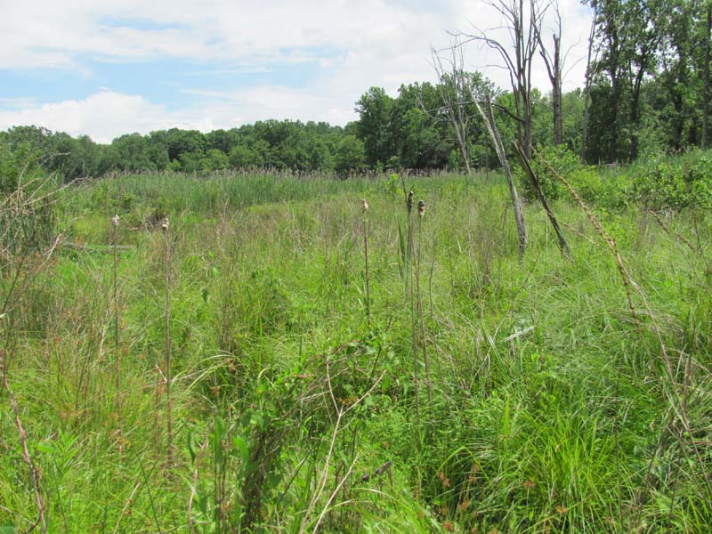
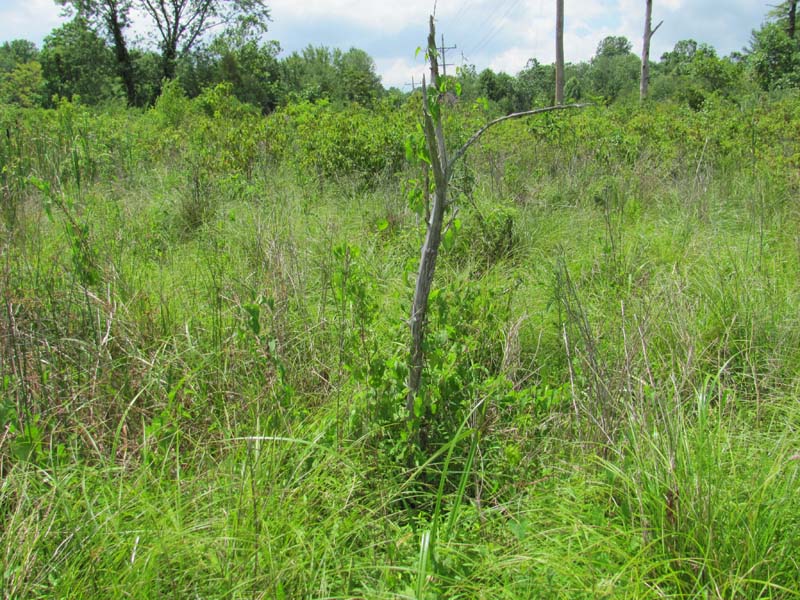
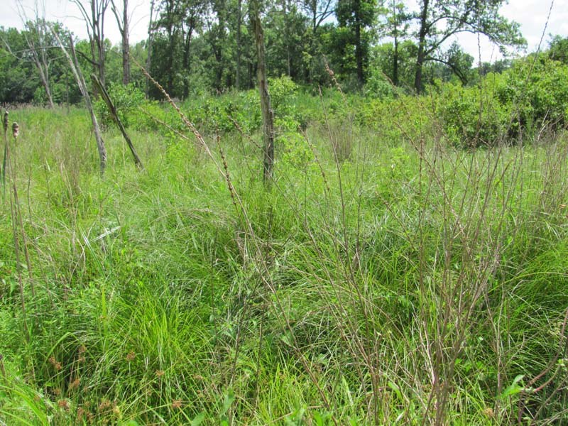
Tussock Sedge Marsh
System: Palustrine
Subsystem: Herbaceous
PA Ecological Group(s): Marsh Wetland
Global Rank:GNR
![]() rank interpretation
rank interpretation
State Rank: S4
General Description
These are tussock sedge (Carex stricta) dominated marshes. The majority of these systems are influenced by past impoundment. The substrate may be peat, muck, or mineral soil. There is generally standing water between the tussocks for much of the year. Associated species include other sedges (e.g., Carex canescens, C. lurida, C. stipata, C. tribuloides), rushes (Juncus spp), bluejoint (Calamagrostis canadensis var. canadensis), tall meadow-rue (Thalictrum pubescens), rough bentgrass (Agrostis scabra), Joe-Pye-weed (Eutrochium spp.), wool-grass (Scirpus cyperinus), water-parsnip (Sium suave), marsh St. John's-wort (Triadenum virginicum), scattered common cat-tail (Typha latifolia), and small red maples (Acer rubrum). The invasive species common reed (Phragmites australis ssp. australis) and purple loosestrife (Lythrum salicaria) are frequently a major problem in these systems.
Rank Justification
Uncommon but not rare; some cause for long-term concern due to declines or other factors.
Identification
- Seasonally flooded basins or on stream or lake margins
- Often influenced by past impoundment
- Substrate may be peat, muck, or mineral soil
- Microtopography is characterized by large tussocks with standing water between the tussocks for much of the year
- Dominated by tussock sedge (Carex stricta)
Trees
Herbs
- Tussock sedge (Carex stricta)
- Sedge (Carex canescens)
- Sedge (Carex lurida)
- Sedge (Carex stipata)
- Sedge (Carex tribuloides)
- Rushes (Juncus spp.)
- Canada bluejoint (Calamagrostis canadensis var. canadensis)
- Tall meadow-rue (Thalictrum pubescens)
- Fly-away grass (Agrostis scabra)
- Joe-pye weed (Eupatorium spp.)
- Wool-grass (Scirpus cyperinus)
- Water-parsnip (Sium suave)
- Marsh St. John's-wort (Triadenum virginicum)
- Common cat-tail (Typha latifolia)
Exotic Species
* limited to sites with higher soil calcium
Vascular plant nomenclature follows Rhoads and Block (2007). Bryophyte nomenclature follows Crum and Anderson (1981).
International Vegetation Classification Associations:
USNVC Crosswalk:None
Representative Community Types:
Eastern Tussock Sedge Meadow (CEGL006412)
NatureServe Ecological Systems:
Laurentian-Acadian Wet Meadow-Shrub Swamp (CES201.582)
High Allegheny Wetland (CES202.069)
NatureServe Group Level:
None
Origin of Concept
Fike, J. 1999. Terrestrial and palustrine plant communities of Pennsylvania. Pennsylvania Natural Diversity Inventory. Pennsylvania Department of Conservation and Recreation, Bureau of Forestry, Harrisburg, PA. 86 pp.
Pennsylvania Community Code*
HT : Tussock Sedge Marsh
*(DCNR 1999, Stone 2006)
Similar Ecological Communities
Tussock Sedge Marsh, Sedge – Mixed Forb Fen, and Bluejoint – Reed Canary-grass Marsh communities can occur in similar settings but the Tussock Sedge Marsh is distinguished by the dominance by tussock sedge (Carex stricta). Bluejoint – Reed Canary-grass Marsh may contain tussock sedge, but it is dominated by bluejoint (Calamagrostis canadensis var. canadensis) and co-dominated by reed canary-grass (Phalaris arundinacea). Sedge – Mixed Forb Fen is strongly dominated by calciphilic species such as prairie sedge (Carex prairea), Atlantic sedge (Carex sterilis), sedge (Carex tetanica), and mountain-mint (Pycnanthemum virginianum).
Fike Crosswalk
Tussock Sedge Marsh
Conservation Value
This community can serve as habitat for the federally endangered bog turtle (Glyptemys muhlenbergii) as well as marsh birds, and foraging habitat for small mammals. This community also serves as a buffer for sediment and pollution runoff from adjacent developed lands by slowing the flow of surficial water causing sediment to settle within this wetland.
Threats
Alteration to the hydrological regime and development are the major threats to this community (e.g., impoundments, beaver dams) and can lead to habitat destruction and/or shifts in community function and dynamics. Clearing and development of adjacent land can lead to an accumulation of agricultural run-off and pollution, sedimentation, and insolation/thermal pollution. Invasive plant species such as purple loosestrife (Lythrum salicaria) and common reed (Phragmites australis ssp. australis) can occur in this community.
Management
A natural buffer around the wetland should be maintained in order to minimize nutrient runoff, pollution, and sedimentation. The potential for soil erosion based on soil texture, condition of the adjacent vegetation (mature forests vs. clearcuts), and the topography of the surrounding area (i.e., degree of slope) should be considered when establishing buffers. The buffer size should be increased if soils are erodible, adjacent vegetation has been logged, and the topography is steep as such factors could contribute to increased sedimentation and nutrient pollution. Direct impacts and habitat alteration should be avoided (e.g., roads, trails, filling of wetlands) and low impact alternatives (e.g., elevated footpaths, boardwalks, bridges) should be utilized in situations where accessing the wetland can not be avoided. Care should also be taken to control and prevent the spread of invasive species within the wetland.
Research Needs
There is a need to collect plot data to characterize variations and guide further classification of this community.
Trends
These wetlands were probably more common but declined due to wetland draining/filling and sedimentation. Tussock Sedge Marsh can result from converting wetlands to pastures. Wetland protection has most likely stabilized the decline of these communities. The relative trend for this community is likely stable or may be declining slightly due to hydrological alterations and exotic species invasions by common reed (Phragmites australis ssp. australis) and purple loosestrife (Lythrum salicaria).
Range Map
Pennsylvania Range
Throughout Pennsylvania
Global Distribution
Connecticut, Delaware (potential), Maine, Maryland, Massachusetts, New Hampshire, New Jersey, New York, Pennsylvania, Rhode Island, Vermont, and West Virginia.
Fike, J. 1999. Terrestrial and palustrine plant communities of Pennsylvania. Pennsylvania Natural Diversity Inventory. Pennsylvania Department of Conservation and Recreation. Bureau of Forestry. Harrisburg, PA.
NatureServe 2010. NatureServe Explorer: An online encyclopedia of life Version 7.1. NatureServe, Arlington, VA. Available http://www.natureserv.org/explorer (accessed: 23 November 2011).
Pennsylvania Department of Conservation and Natural Resources (DCNR). 1999. Inventory Manual of Procedure. For the Fourth State Forest Management Plan. Pennsylvania Bureau of Forestry, Division of Forest Advisory Service. Harrisburg, PA. 51 ppg.
Rhoads, Ann F. and Timothy A. Block. 1999. Natural Areas Inventory of Bucks County, Pennsylvania. Bucks County Commissioners, Doylestown, PA.
Rhoads, Ann F. and Timothy A. Block. 2004. Nockamixon State Park Natural Resources Inventory. Report submitted to DCNR, Bureauof State Parks.
Rhoads, Ann F. and Timothy A. Block. 2008. Natural Areas Inventory Update, Montgomery County, Pennsylvania. Montgomery County Planning Commission, Norristown, PA.
Rhoads, Ann F. and Timothy A. Block. 2008. Natural Resources Inventory of French Creek State Park. Report submitted to DCNR, Bureau of State Parks.
Stone, B., D. Gustafson, and B. Jones. 2006 (revised). Manual of Procedure for State Game Land Cover Typing. Commonwealth of Pennsylvania Game Commission, Bureau of Wildlife Habitat Management, Forest Inventory and Analysis Section, Forestry Division. Harrisburg, PA. 79 ppg.
Cite as:
Eichelberger, B. 2022. Pennsylvania Natural Heritage Program. Tussock Sedge Marsh Factsheet. Available from: https://www.naturalheritage.state.pa.us/Community.aspx?=16015 Date Accessed: January 13, 2026


