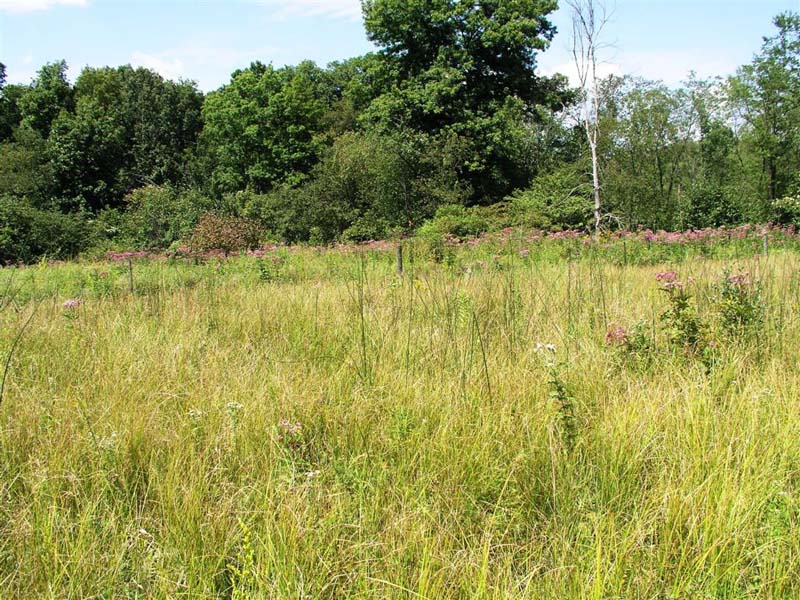
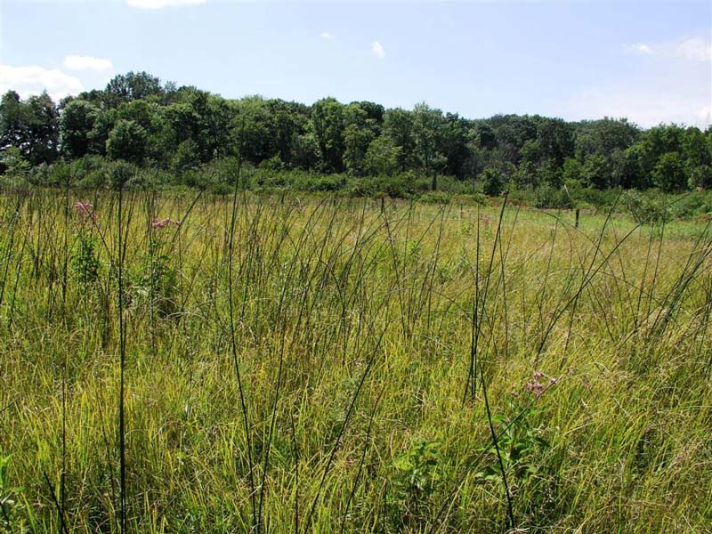
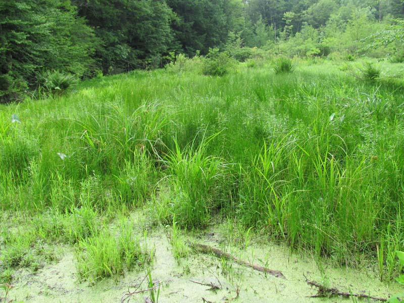
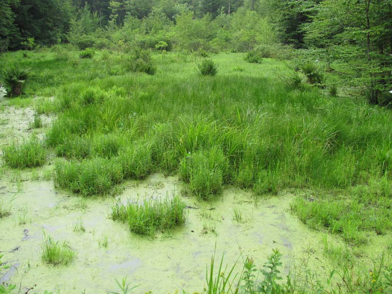
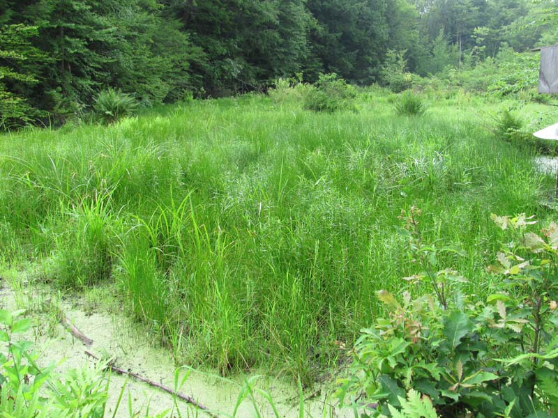
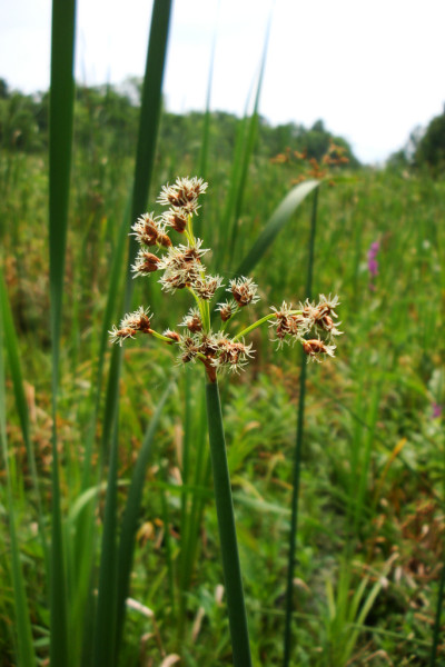
Mixed Forb – Graminoid Wet Meadow
System: Palustrine
Subsystem: Herbaceous
PA Ecological Group(s): Basin wetland
Global Rank:GNR
![]() rank interpretation
rank interpretation
State Rank: S5
General Description
This is an open, commonly occurring plant community dominated by herbaceous vegetation. They are typically saturated or inundated early in the growing season, but may be dry by mid- to late-summer. The substrate is typically mineral soil with or without a layer of muck at the surface. Although flooded or saturated soils may help to keep these systems open, most are also grazed or mowed.
This plant composition of this association is diverse, though some sites may be dominated by one or two species. Representative species include a combination of graminoid and forb species. Species include goldenrods (Solidago spp.), rice cutgrass (Leersia oryzoides), wool-grass (Scirpus cyperinus), bugleweed (Lycopus uniflorus), smartweeds (Persicaria spp.), sedges (Carex stipata var. stipata, C. canescens, C. lurida, C. cristatella, C. tribuloides, C. vesicaria, C. stricta), soft rush (Juncus effusus), Joe-Pye-weed (Eutrochium spp.), boneset (Eupatorium perfoliatum), cinnamon fern (Osmunda cinnamomea), royal fern (Osmunda regalis), Canadian St. John's-wort (Hypericum canadense), bluejoint (Calamagrostis canadensis var. canadensis), New York ironweed (Vernonia noveboracensis), Virginia chain fern (Woodwardia virginica), beggar-ticks (Bidens spp.), dwarf St. John's-wort (Hypericum mutilum), bulrush (Scirpus spp.), marsh St. John's-wort (Triadenum virginicum), rattlesnake mannagrass (Glyceria canadensis), and spike-rushes (Eleocharis spp.). Scattered shrubs may be present, representative species include steeplebush (Spiraea tomentosa), silky dogwood (Cornus amomum), gray dogwood (Cornus racemosa), red-osier dogwood (Cornus sericea), and arrow-wood (Viburnum recognitum). Exotic species such as purple loosestrife (Lythrum salicaria) and a variety of non-native grasses, such as reed canary-grass (Phalaris arundinacea), are frequently found in these meadows.
Rank Justification
Common, widespread, and abundant in the jurisdiction.
Identification
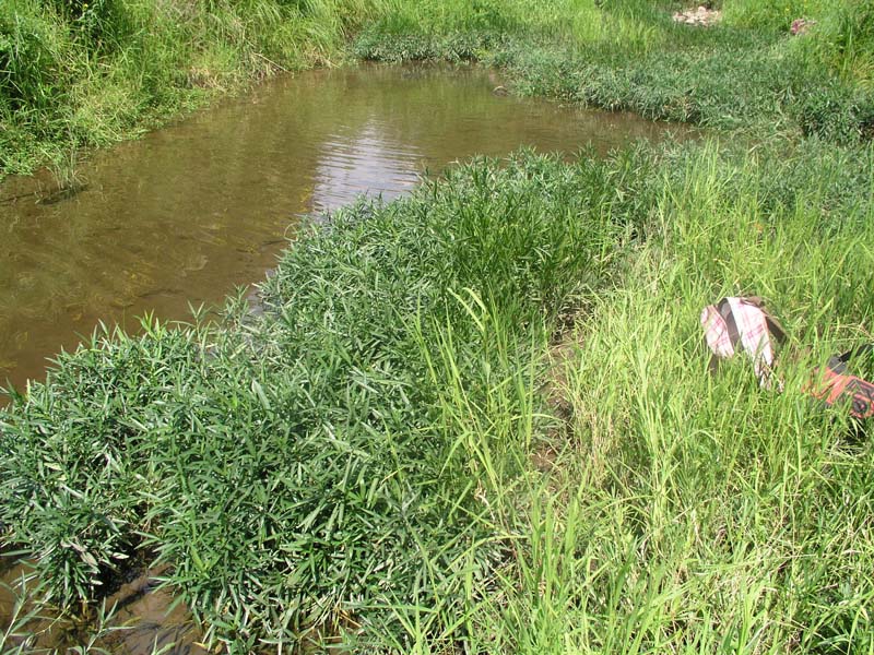
- Wet alluvial bottomlands, beaver ponds, as well as wet portions of old fields and open grasslands
- Soils are poorly drained, acidic clay loams
- Dominated by grasses and forbs, with scattered trees and shrubs
Shrubs
Herbs
- Rice cutgrass (Leersia oryzoides)
- Wool-grass (Scirpus cyperinus)
- Bugleweed (Lycopus uniflorus)
- Pale meadowgrass (Torreyochloa pallida)
- Smartweeds (Persicaria spp.)
- Three-way sedge (Dulichium arundinaceum var. arundinaceum)
- Marsh fern (Thelypteris palustris)
- Sedge (Carex stipata)
- Sedge (Carex canescens)
- Sedge (Carex lurida)
- Sedge (Carex cristatella)
- Sedge (Carex tribuloides)
- Sedge (Carex vesicaria)
- Tussock sedge (Carex stricta)
- Soft rush (Juncus effusus)
- Virginia chain fern (Woodwardia virginica)
- Beggar-ticks (Bidens spp.)
- Dwarf St. John's-wort (Hypericum mutilum)
- Joe-pye-weed (Eutrochium spp.)
- Boneset (Eupatorium perfoliatum)
- Cinnamon fern (Osmunda cinnamomea)
- Royal fern (Osmunda regalis)
- Canadian St. John's-wort (Hypericum canadense)
- Canada bluejoint (Calamagrostis canadensis var. canadensis)
- New York ironweed (Vernonia noveboracensis)
- Marsh St. John's-wort (Triadenum virginicum)
- Goldenrods (Solidago spp.)
- Rattlesnake mannagrass (Glyceria canadensis)
- Black bulrush (Scirpus atrovirens)
- Bulrush (Scirpus pendulus)
- Spike-rushes (Eleocharis spp.)
* limited to sites with higher soil calcium
Vascular plant nomenclature follows Rhoads and Block (2007). Bryophyte nomenclature follows Crum and Anderson (1981).
International Vegetation Classification Associations:
USNVC Crosswalk:None
Representative Community Types:
Central Appalachian Cutgrass Marsh (CEGL006461)
NatureServe Ecological Systems:
High Allegheny Wetland (CES202.069)
Central Appalachian Stream and Riparian (CES202.609)
NatureServe Group Level:
None
Origin of Concept
Fike, J. 1999. Terrestrial and palustrine plant communities of Pennsylvania. Pennsylvania Natural Diversity Inventory. Pennsylvania Department of Conservation and Recreation, Bureau of Forestry, Harrisburg, PA. 86 pp.
Pennsylvania Community Code*
HM : Wet Meadow
*(DCNR 1999, Stone 2006)
Similar Ecological Communities
Mixed Forb - Graminoid Wet Meadow represents a community that has a mixture of forbs and graminoids and can be distinguished from other types by the diverse mixture of species and lack of a clear dominant. Although reed canary-grass (Phalaris arundinacea) and bluejoint (Calamagrostis canadensis var. canadensis) may occur in this community type, they are not dominant. If one of these species or a combination of the two dominates the community, the community may be better represented by Bluejoint – Reed Canary-grass Marsh. If tussock sedge (Carex stricta) strongly dominates the community, then the community would better be represented by Tussock Sedge Marsh. If the community is a seasonally flooded basin that collects water during the winter and spring, then the community is better represented by the Rice Cutgrass – Bulrush Vernal Pool or Wool-grass – Mannagrass – Mixed Shrub Vernal Pool. This community may also be similar is species composition with the Floodplain Meadow. It differs from the floodplain type in landscape position, as it is usually located outside of the active floodplain, and the presence of riparian plant species.
Fike Crosswalk
Wet Meadow
Conservation Value
This community serves as habitat for small mammals and may serve as a foraging area for raptor species. This community also serves as a buffer for sediment and pollution runoff from adjacent developed lands by slowing the flow of surficial water causing sediment to settle within this wetland.
Threats
Alteration to the hydrological regime and development are the major threats to this community and can lead to habitat destruction and/or shifts in community function and dynamics. Clearing and development of adjacent land can lead to an accumulation of agricultural run-off and pollution, sedimentation, and insolation/thermal pollution. Invasive plant species such as purple loosestrife (Lythrum salicaria) and common reed (Phragmites australis) can occur in this community.
Management
A natural buffer around the wetland should be maintained in order to minimize nutrient runoff, pollution, and sedimentation. The potential for soil erosion based on soil texture, condition of the adjacent vegetation (mature forests vs. clearcuts), and the topography of the surrounding area (i.e., degree of slope) should be considered when establishing buffers. The buffer size should be increased if soils are erodible, adjacent vegetation has been logged, and the topography is steep as such factors could contribute to increased sedimentation and nutrient pollution. Direct impacts and habitat alteration should be avoided (e.g., roads, trails, filling of wetlands) and low impact alternatives (e.g., elevated footpaths, boardwalks, bridges) should be utilized in situations where accessing the wetland can not be avoided. Care should also be taken to control and prevent the spread of invasive species within the wetland.
Research Needs
There is a need to characterize variations of this community to refine the description and classification of this type.
Trends
These wetlands were probably more common but declined due to wetland draining/filling and clearing of the adjacent lands leading to increased sedimentation. Wetland protection has most likely stabilized the decline of these communities. The relative trend for this community is likely stable or may be declining slightly due to hydrological alterations.
Range Map
Pennsylvania Range
Statewide.
Global Distribution
New York, Pennsylvania, Virginia, and West Virginia.
Byers, E. A., J. P. Vanderhorst, and B. P. Streets. 2007. Classification and conservation assessment of high elevation wetland communities in the Allegheny Mountains of West Virginia. West Virginia Natural Heritage Program, West Virginia Division of Natural Resources, Elkins.
Eastern Ecology Working Group of NatureServe. No date. International Ecological Classification Standard: International Vegetation Classification. Terrestrial Vegetation. NatureServe, Boston, MA.
Fike, J. 1999. Terrestrial and palustrine plant communities of Pennsylvania. Pennsylvania Natural Diversity Inventory. Pennsylvania Department of Conservation and Recreation. Bureau of Forestry. Harrisburg, PA.
Grafton, W. N., and O. L. Eye. 1982. Vascular flora of eight selected West Virginia wetlands with special reference to rare species. Pages 107-115 in: Proceedings of the Symposium on Wetlands of the Unglaciated Appalachian Region. West Virginia University, Morgantown.
Khan, Nancy R., Ann F. Rhoads, and Timothy A. Block. 2005. Characterization and assessmant of the Floristic Resources in Evansburg State Park. Report submitted to DCNR, Bureau of State Parks.
Khan, Nancy R., Ann F. Rhoads, and Timothy A. Block. 2008. Vascular flora and community assemblages of Evansburg State Park, Montgomery County, Pennsylvania. Bulletin of the Torrey Botanical Club 135(3): 438-458.
NatureServe 2010. NatureServe Explorer: An online encyclopedia of life Version 7.1. NatureServe, Arlington, VA. Available http://www.natureserv.org/explorer (accessed: 23 November 2011).
Pennsylvania Department of Conservation and Natural Resources (DCNR). 1999. Inventory Manual of Procedure. For the Fourth State Forest Management Plan. Pennsylvania Bureau of Forestry, Division of Forest Advisory Service. Harrisburg, PA. 51 ppg.
Putnam, N. [1995]. Plant communities of the Meadow River wetlands. Final report submitted to the West Virginia Division of Natural Resources.
Rhoads, Ann F. and Timothy A. Block. 2004. Lehigh Gorge State Park Natural Resource Inventory. Report submitted to DCNR, Bureau of State Parks.
Rhoads, Ann F. and Timothy A. Block. 2004. Nockamixon State Park Natural Resources Inventory. Report submitted to DCNR, Bureauof State Parks.
Rhoads, Ann F. and Timothy A. Block. 2005. Jacobsburg Environmental Education Center Vegetation Inventory. Report submitted to DCNR, Bureau of State Parks.
Rhoads, Ann F. and Timothy A. Block. 2005. Lackawanna State Park Vegetation Inventory. Report Submitted to DCNR, Bureau of State Parks.
Rhoads, Ann F. and Timothy A. Block. 2008. Natural Areas Inventory Update, Montgomery County, Pennsylvania. Montgomery County Planning Commission, Norristown, PA.
Stone, B., D. Gustafson, and B. Jones. 2006 (revised). Manual of Procedure for State Game Land Cover Typing. Commonwealth of Pennsylvania Game Commission, Bureau of Wildlife Habitat Management, Forest Inventory and Analysis Section, Forestry Division. Harrisburg, PA. 79 ppg.
Vanderhorst, J. 2001a. Plant community classification and mapping of the Camp Dawson Collective Training Area, Preston County, West Virginia. West Virginia Natural Heritage Program, West Virginia Division of Natural Resources, Elkins. 101 pp.
Vanderhorst, J. 2001b. Plant communities of the New River Gorge National River, West Virginia: Northern and southern thirds. Non-game Wildlife and Natural Heritage Program, West Virginia Division of Natural Resources. Elkins. 146 pp.
Vanderhorst, J. P., J. Jeuck, and S. C. Gawler. 2007. Vegetation classification and mapping of New River Gorge National River, West Virginia. Technical Report NPS/NER/NRTR-2007/092. USDI National Park Service. Philadelphia, PA.
Vanderhorst, J., and B. P. Streets. 2006. Vegetation classification and mapping of Camp Dawson Army Training Site, West Virginia: Second approximation. Natural Heritage Program, West Virginia Division of Natural Resources, Elkins. 83 pp.
Walbridge, M. R. 1982. Vegetation patterning and community distribution in four high-elevation headwater wetlands in West Virginia. M.S. thesis, West Virginia University, Morgantown.
Walbridge, M. R., and G. E. Lang. 1982. Major plant communities and patterns of community distribution in four wetlands of the unglaciated Appalachian region. In: R. B. MacDonald, editor. Proceedings of the Symposium on Wetlands of the Unglaciated Appalachian Region. West Virginia University, Morgantown.
Walton, D. P., C. M. Jesse, and N. J. Putnam. 1996. Plant communities of the Ohio River riparian zone. Natural Heritage Program, West Virginia Division of Natural Resources, Elkins.

Cite as:
Eichelberger, B. 2022. Pennsylvania Natural Heritage Program. Mixed Forb – Graminoid Wet Meadow Factsheet. Available from: https://www.naturalheritage.state.pa.us/Community.aspx?=16016 Date Accessed: April 18, 2024


