Leatherleaf – Sedge Wetland
System: Palustrine
Subsystem: Shrubland
PA Ecological Group(s): Peatland Wetland
Global Rank:GNR
![]() rank interpretation
rank interpretation
State Rank: S3
General Description
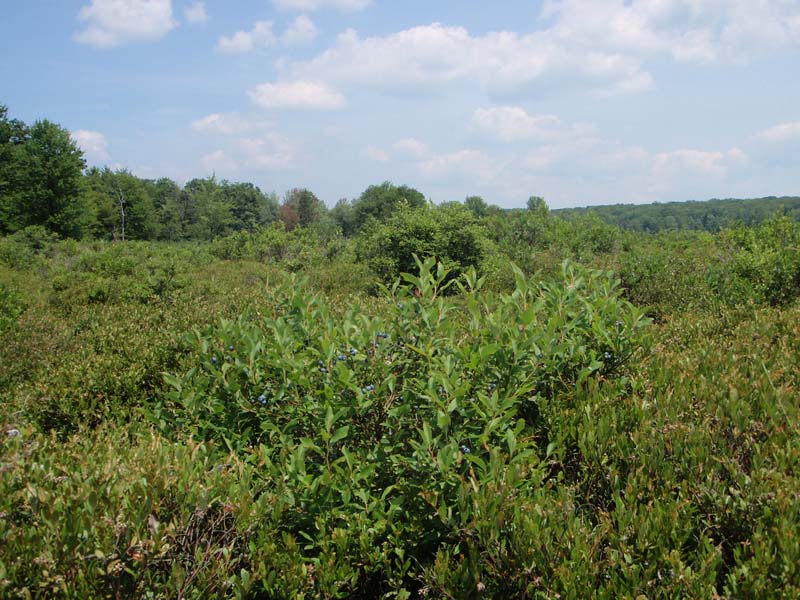
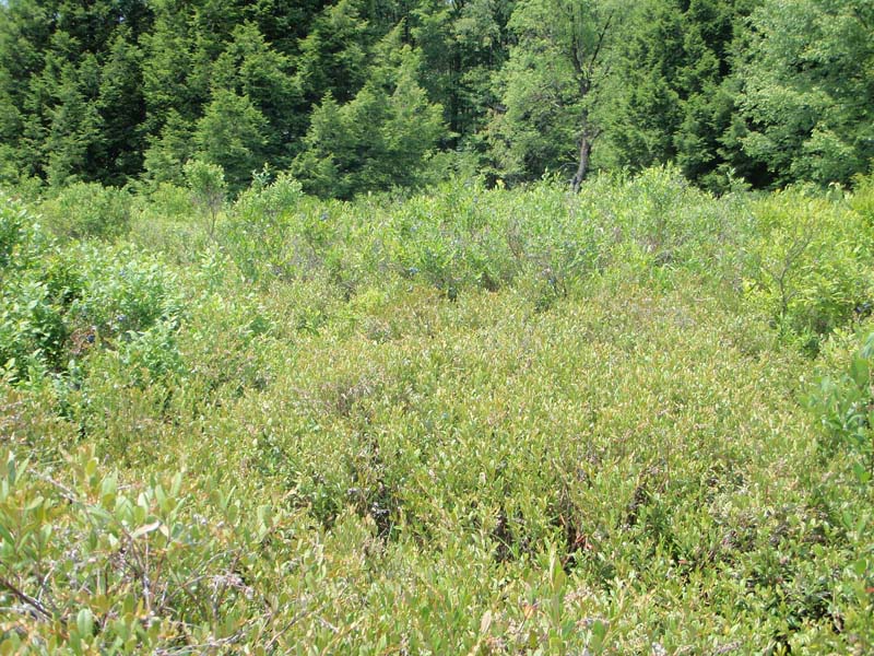
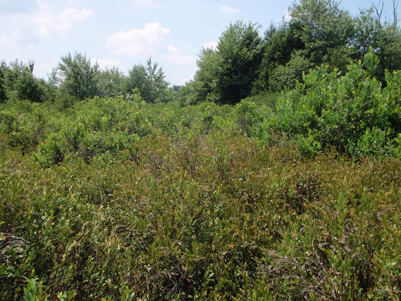
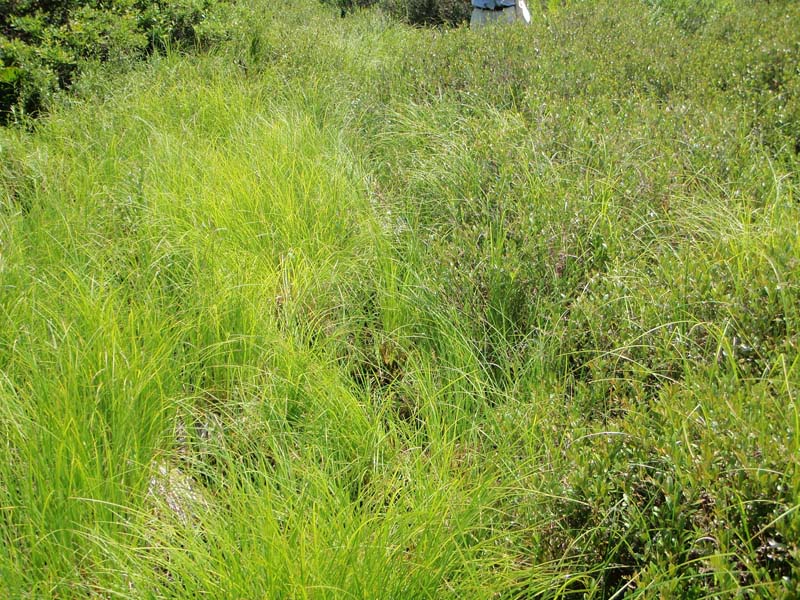
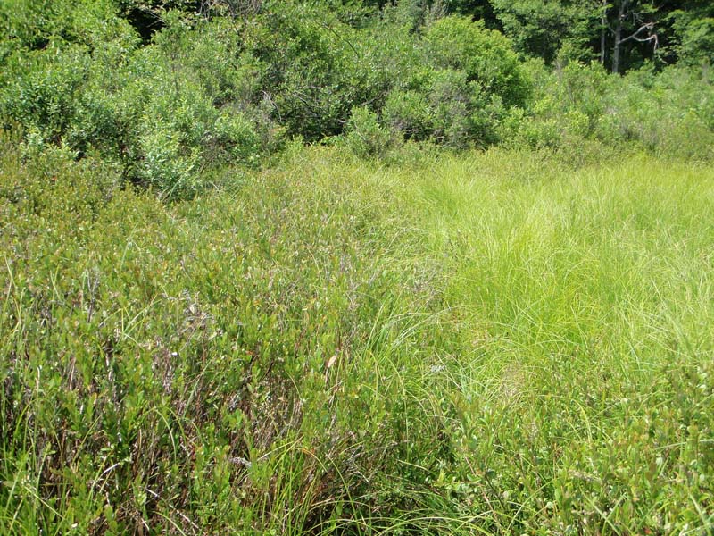
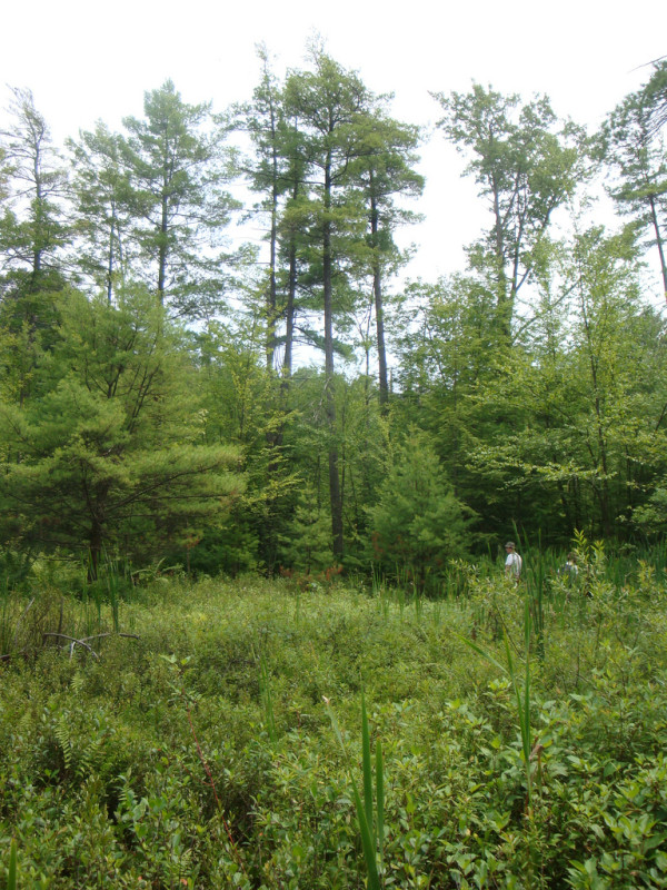
This short shrub-dominated (less than 1 m in height) community occurs in upland depressions and areas with a past impoundment history (often beaver influenced) and may also occur at the lake-bog mat interface. This community type, when formed under disturbance conditions (e.g., impoundment), may be ephemeral. The community may occur over an extensive area or occupy a narrow fringe between herbaceous vegetation and taller shrub and tree dominated zones. The substrate may be either organic or mineral soil with a substantial accumulation of organic matter. This community experiences an extended hydroperiod ranging from standing water to saturated soils.
Leatherleaf (Chamaedaphne calyculata var. angustifolia) dominates this community along with a mix of sedges and other herbs. There is usually at least a partial layer of sphagnum. In more nitrogen-poor situations, round-leaved sundew (Drosera rotundifolia) and occasionally pitcher-plant (Sarracenia purpurea) may occur. Graminoids are common including sedges (Carex canescens, Carex trisperma, Carex folliculata, Carex lasiocarpa, Carex rostrata, and Carex stricta), cotton-grass (Eriophorum vaginatum), and three-way sedge (Dulichium arundinaceum var. arundinaceum). Other herbs include wapato (Sagittaria latifolia), marsh cinquefoil (Potentilla palustris), swamp-candles (Lysimachia terrestris), cranberry (Vaccinium macrocarpon), and marsh St. John's-wort (Triadenum virginicum).
Rank Justification
Vulnerable in the nation or state due to a restricted range, relatively few populations (often 80 or fewer), recent and widespread declines, or other factors making it vulnerable to extirpation.
Identification
- Occurs in upland depressions, areas with past impoundment histories, and at the lake-bog mat interface
- Substrate is either organic or mineral with a substantial organic horizon
- Evidence of an extended hydroperiod (e.g., standing water or saturated soils)
- The shrub layer is usually less than 1 m in height and almost exclusively dominated by leatherleaf (Chamaedaphne calyculata var. angustifolia)
- Sedges and herbs are present along with at least a partial sphagnum layer
Herbs
- Round-leaved sundew (Drosera rotundifolia)
- Sedge (Carex canescens)
- Sedge (Carex trisperma)
- Sedge (Carex folliculata)
- Many-fruited sedge (Carex lasiocarpa)
- Tussock sedge (Carex stricta)
- Cotton-grass (Eriophorum vaginatum)
- Three-way sedge (Dulichium arundinaceum var. arundinaceum)
- Wapato (Sagittaria latifolia)
- Marsh cinquefoil (Potentilla palustris)
- Cranberry (Vaccinium macrocarpon)
- Marsh St. John's-wort (Triadenum virginicum)
- Sedge (Carex rostrata)
Bryophytes
* limited to sites with higher soil calcium
Vascular plant nomenclature follows Rhoads and Block (2007). Bryophyte nomenclature follows Crum and Anderson (1981).
International Vegetation Classification Associations:
USNVC Crosswalk:None
Representative Community Types:
Medium Fen (CEGL006302)
NatureServe Ecological Systems:
North-Central Interior and Appalachian Acidic Peatland (CES202.606)
NatureServe Group Level:
None
Origin of Concept
Fike, J. 1999. Terrestrial and palustrine plant communities of Pennsylvania. Pennsylvania Natural Diversity Inventory. Pennsylvania Department of Conservation and Recreation, Bureau of Forestry, Harrisburg, PA. 86 pp.
Pennsylvania Community Code*
SD : Leatherleaf – Sedge Wetland
*(DCNR 1999, Stone 2006)
Similar Ecological Communities
The Leatherleaf – Cranberry Bog and Leatherleaf – Bog-rosemary Bog community types are typically found in glacial bogs, are more acidic, and have a deeper organic layer, sometimes occurring on a floating mat of sphagnum peat. The Leatherleaf – Sedge Wetland community generally has a greater cover and diversity in the herbaceous layer (mostly sedge dominated).
Fike Crosswalk
Leatherleaf – Sedge Wetland
Conservation Value
Rare plant species that may be found in this community include many-fruited sedge (Carex lasiocarpa), few-seeded sedge (Carex oligosperma), bog sedge (Carex paupercula), marsh willow-herb (Epilobium palustre), bog muhly (Muhlenbergia uniflora), Labrador-tea (Rhododendron groenlandicum), and bog goldenrod (Solidago uliginosa). This community also serves as a buffer for sediment and pollution runoff from adjacent developed lands by slowing the flow of surficial water causing sediment to settle within this wetland.
Threats
Leatherleaf – Sedge Wetlands are threatened by habitat alteration (e.g., conversion to agricultural land, logging in adjacent uplands), deposition (e.g., sedimentation, nutrient loading), and alterations to the hydrological regime (e.g., removal of beaver dams or other impoundments, lowering of the water table). This community type may be more susceptible to degradation due to the fact that it is often associated with small, isolated basins. Invasive species such as reed canary-grass (Phalaris arundinacea) may alter the species composition of this community type. Plant collection pressure may add to the degradation of this community type.
Management
Because Leatherleaf – Sedge Wetlands are relatively acidic and low in nutrients, they are susceptible to alteration by elevated nutrient inputs. This wetland may require larger buffers than other wetland types because of their high susceptibility to changes in nutrient concentrations.
A natural buffer around the wetland should be maintained in order to minimize nutrient runoff, pollution, and sedimentation. The potential for soil erosion based on soil texture, condition of the adjacent vegetation (mature forests vs. clearcuts), and the topography of the surrounding area (i.e., degree of slope) should be considered when establishing buffers. The buffer size should be increased if soils are erodible, adjacent vegetation has been logged, and the topography is steep as such factors could contribute to increased sedimentation and nutrient pollution. Direct impacts and habitat alteration should be avoided (e.g., roads, trails, filling of wetlands) and low impact alternatives (e.g., elevated footpaths, boardwalks, bridges) should be utilized in situations where accessing the wetland cannot be avoided. Care should also be taken to control and prevent the spread of invasive species within the wetland. Alterations to groundwater sources should be minimized.
Research Needs
Research is needed to fill information gaps about this community type, especially to advance our understanding of their classification, ecological processes, hydrology, floristic variation, development, and succession.
Trends
Wetland protection has most likely stabilized the decline of these communities. The relative trend for this community is most likely stable or may decline slightly due to hydrological alteration or ecological succession.
Range Map
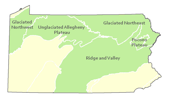
Pennsylvania Range
Glaciated Northeast, Glaciated Northwest, Pocono Plateau, Ridge and Valley, and Unglaciated Allegheny Plateau.
Global Distribution
Connecticut, Massachusetts, Maine, New Hampshire, New York, Pennsylvania, Rhode Island, and Vermont.
Edinger, G.J., D.J. Evans, S. Gebauer, T.G. Howard, D.M. Hunt, and A. M. Olivero (editors). 2002. Ecological Communities of New York. Second Edition. A revised and expanded edition of Carol Reschke’s Ecological Communities of New York State. New York Natural Heritage Program, New York State department of Environmental Conservation. Albany, NY. 136pp.
Fike, J. 1999. Terrestrial and palustrine plant communities of Pennsylvania. Pennsylvania Natural Diversity Inventory. Harrisburg, PA 79 pp.
NatureServe. 2005. NatureServe Central Databases. Arlington, Virginia. USA.
Pennsylvania Department of Conservation and Natural Resources (DCNR). 1999. Inventory Manual of Procedure. For the Fourth State Forest Management Plan. Pennsylvania Bureau of Forestry, Division of Forest Advisory Service. Harrisburg, PA. 51 ppg.
Rhoads, Ann F. and Timothy A. Block. 2002. Tobyhanna State Park Natural Areas Survey. Report submitted to DCNR, Bureau of State Parks.
Rhoads, Ann F. and Timothy A. Block. 2006. Vegetation Inventory of Gouldsboro State Park. Report submitted to DCNR, Bureau of State Parks.
Stone, B., D. Gustafson, and B. Jones. 2006 (revised). Manual of Procedure for State Game Land Cover Typing. Commonwealth of Pennsylvania Game Commission, Bureau of Wildlife Habitat Management, Forest Inventory and Analysis Section, Forestry Division. Harrisburg, PA. 79 ppg.

Cite as:
Furedi, M. 2022. Pennsylvania Natural Heritage Program. Leatherleaf – Sedge Wetland Factsheet. Available from: https://www.naturalheritage.state.pa.us/Community.aspx?=16043 Date Accessed: January 13, 2026


