Periodically Exposed Shoreline Community
System: Palustrine
Subsystem: Sparse Vegetation
PA Ecological Group(s):
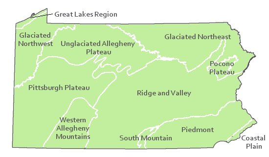
River Floodplain and Sparse Vegetation
Global Rank:G4G5
![]() rank interpretation
rank interpretation
State Rank: S5
General Description
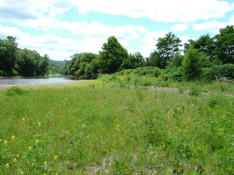
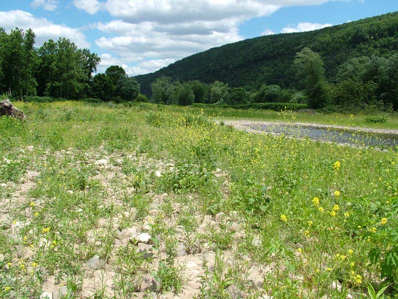
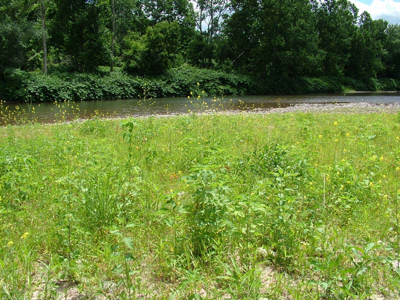
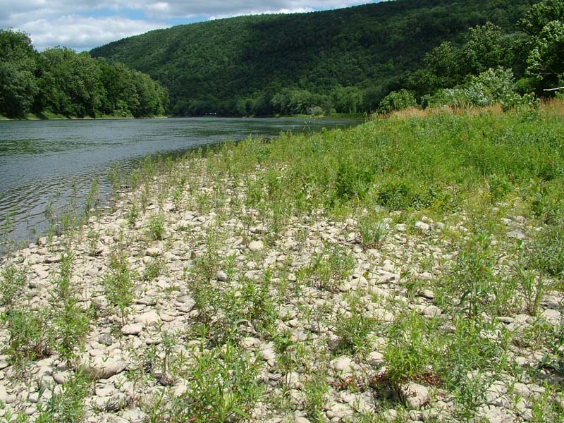
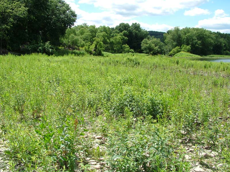
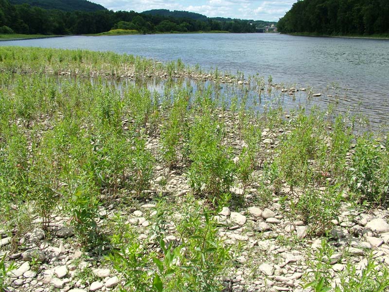
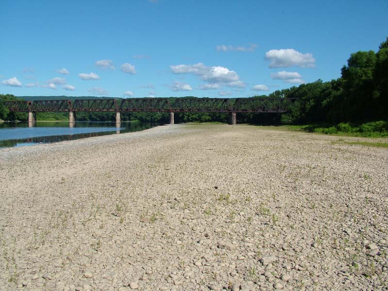
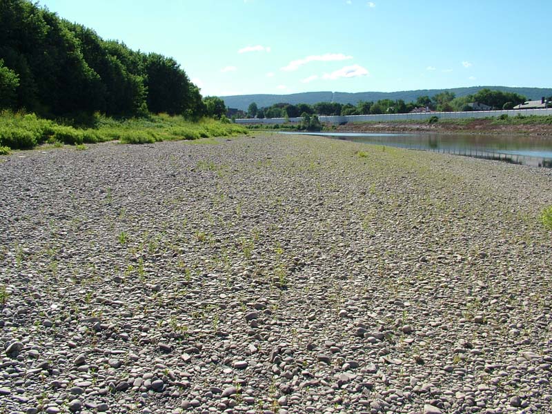
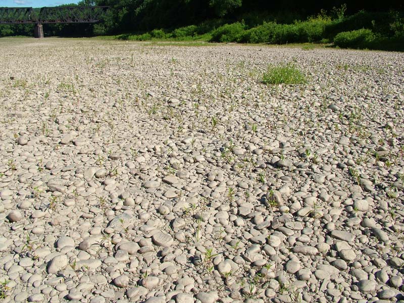
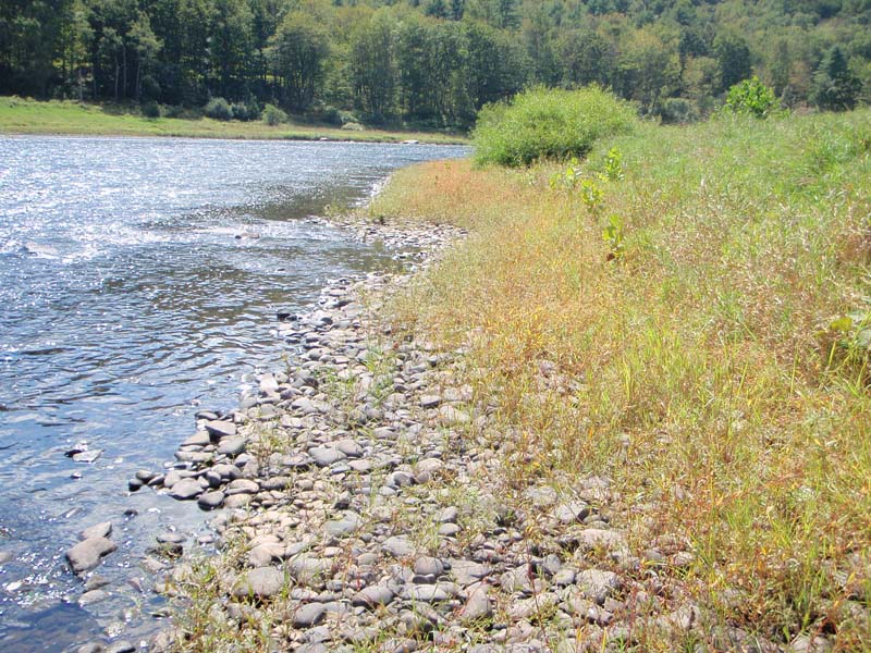
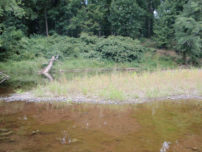
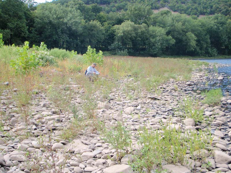
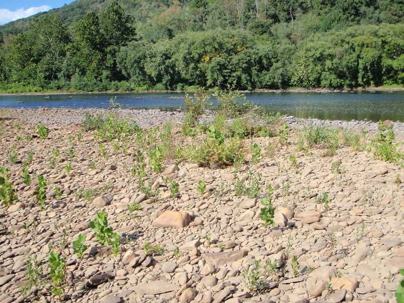
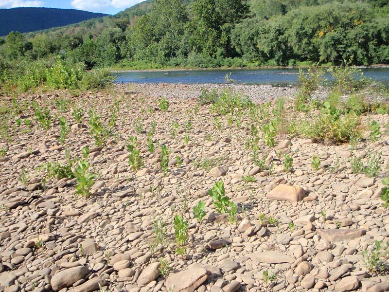
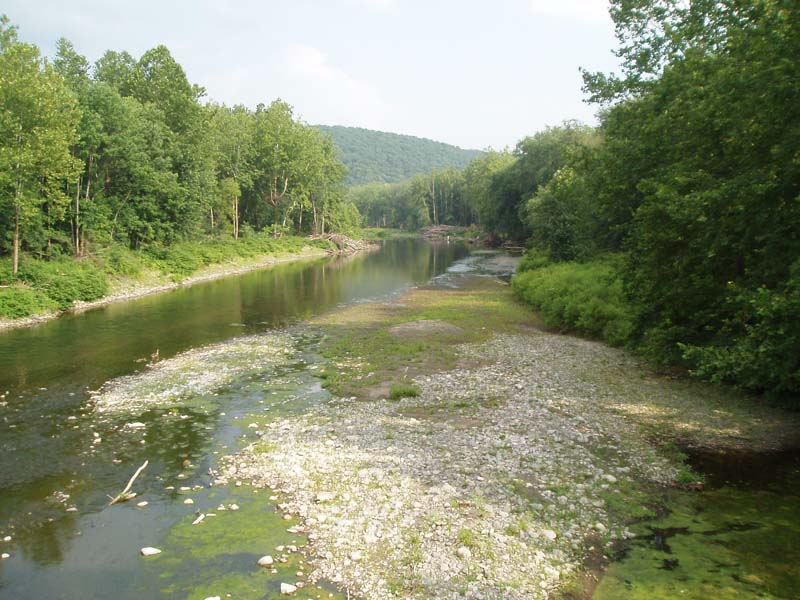
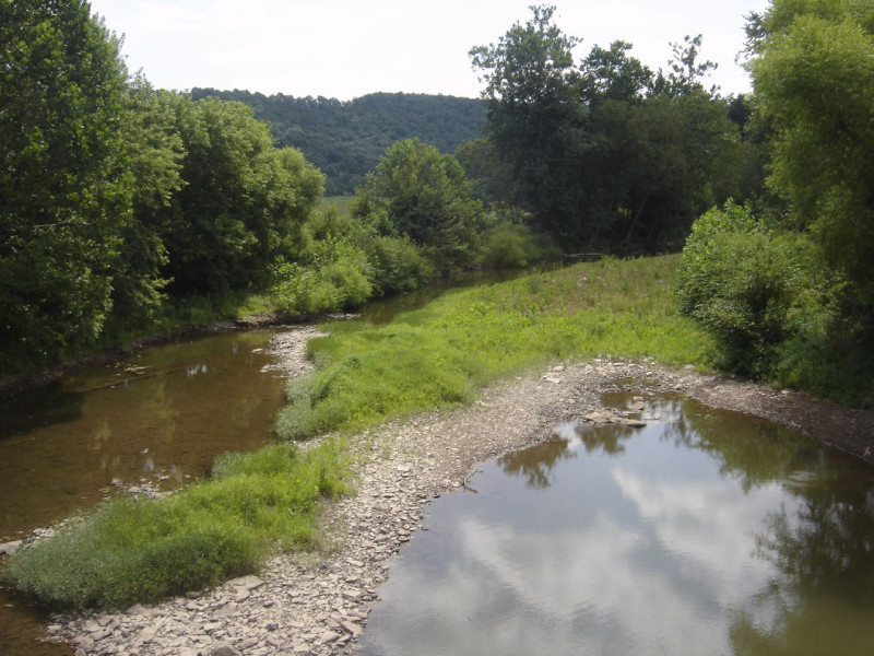
This community is found on all orders of streams, and in a wide variety of riverine settings including island heads, bars, spits, low terraces, and river banks. The underlying substrate also varies greatly, although it is often cobbles and sand with thin deposits of silt, muck, or organic matter. Species composition also varies greatly from site to site. The unifying factor influencing the species composition is the frequent inundation and scour that these sites experience. This community is generally situated in areas of the active channel that are underwater for the majority of the year and are exposed only at low water or in drought years. These areas are subjected to high water velocities, floods, and ice scour more frequently than many other herbaceous communities within the river floodplain system. The constant scour removes established vegetation and maintains or creates exposed sediments, cobbles, or bedrock. New seeds and plant propagules are constantly being dispersed to these areas by water, air, and animals. This causes a continual flux in species composition that is characteristic of this community.
This type typically describes sparsely vegetated sites. The species composition of the community varies depending upon the available seed bank, surrounding vegetation, type of substrate, ecoregion, and hydrologic conditions. Non-native and opportunistic species, many of which are annuals, make up a high proportion of the vegetation at these sites. The perennial species that do exist are those that can tolerate the frequent disturbance of flood events. Not all of the species listed below will be present at the same site. Many combinations and variations in species composition are possible but may include water-pepper (Persicaria punctata), smartweed (P. pensylvanicum), water smartweed (P. amphibia), straw-colored nutsedge (Cyperus strigosus), redroot flatsedge (Cyperus erythrorhizos), lovegrass (Eragrostis frankii), three-seeded mercury (Acalypha rhomboidea), blue vervain (Verbena hastata), cordgrass (Spartina pectinata), boneset (Eupatorium perfoliatum), willow-herb (Epilobium ciliatum), pale St. John’s-wort (Hypericum ellipticum), dwarf St. John’s-wort (H. mutilum), garden loosestrife (Lysimachia vulgaris), swamp-candles (Lysimachia terrestris), American barnyard grass (Echinochloa muricata), late-flowering thoroughwort (Eupatorium serotinum), marsh-purslane (Ludwigia palustris), Autumn bent (Agrostis perennans), cocklebur (Xanthium strumarium), evening-primrose (Oenothera biennis), clearweed (Pilea pumila), Allegheny monkey-flower (Mimulus ringens), false pimpernel (Lindernia dubia), bugleweed (Lycopus uniflorus), cardinal-flower (Lobelia cardinalis), marsh St. John’s-wort (Triadenum virginicum), marsh pennywort (Hydrocotyle americana), field horsetail (Equisetum arvense), spikerushes (Eleocharis erythropoda, E. palustris, E. acicularis, E. tenuis, and E. obtusa), rushes (Juncus acuminatus, Juncus canadensis), spotted spurge (Euphorbia maculata), carpetweed (Mollugo verticillata), lady’s-thumb (Persicaria maculosa), low smartweed (Persicaria longiseta),creeping lovegrass (Eragrostis hypnoides), and umbrella sedge (Cyperus squarrosus). Exotic species found in this community include purple loosestrife (Lythrum salicaria), reed canary-grass (Phalaris arundinacea), Japanese knotweed (Fallopia japonica), and Japanese stiltgrass (Microstegium vimineum)
Rank Justification
Common, widespread, and abundant in the jurisdiction.
Identification
- Found on all orders of streams, and in a wide variety of riverine settings including island heads, bars, spits, low terraces, and river banks
- Sparsely to densely vegetated, comprised of weedy, opportunistic natives and exotic plants
- Substrate is variable
- Maintained by annual episodes of high intensity flooding and ice scour
Shrubs
Herbs
- Dotted smartweed (Persicaria punctata)
- Smartweed (Persicaria pensylvanica)
- Water smartweed (Persicaria amphibia)
- False nutsedge (Cyperus strigosus)
- Redroot flatsedge (Cyperus erythrorhizos)
- Lovegrass (Eragrostis frankii)
- Three-seeded mercury (Acalypha rhomboidea)
- Blue vervain (Verbena hastata)
- Freshwater cordgrass (Spartina pectinata)
- Boneset (Eupatorium perfoliatum)
- Pale St. John's-wort (Hypericum ellipticum)
- Dwarf St. John's-wort (Hypericum mutilum)
- Garden loosestrife (Lysimachia vulgaris)
- Swamp-candles (Lysimachia terrestris)
- Barnyard-grass (Echinochloa muricata)
- Late eupatorium (Eupatorium serotinum)
- Marsh-purslane (Ludwigia palustris)
- Autumn bent (Agrostis perennans)
- Common cocklebur (Xanthium strumarium)
- Evening-primrose (Oenothera biennis)
- Clearweed (Pilea pumila)
- Allegheny monkey-flower (Mimulus ringens)
- False pimpernel (Lindernia dubia)
- Bugleweed (Lycopus uniflorus)
- Cardinal-flower (Lobelia cardinalis)
- Marsh St. John's-wort (Triadenum virginicum)
- Marsh pennywort (Hydrocotyle americana)
- Field horsetail (Equisetum arvense)
- Spike-rush (Eleocharis erythropoda)
- Creeping spike-rush (Eleocharis palustris)
- Needle spike-rush (Eleocharis acicularis)
- Slender spike-rush (Eleocharis tenuis var. pseudoptera)
- Wright's spike-rush (Eleocharis obtusa)
- Sharp-fruited rush (Juncus acuminatus)
- Canada rush (Juncus canadensis)
- Water-willow (Justicia americana)
- Spotted spurge (Euphorbia maculata)
- Carpetweed (Mollugo verticillata)
- Lady's-thumb (Persicaria maculosa)
- Low smartweed (Persicaria longiseta)
- Creeping lovegrass (Eragrostis hypnoides)
- Umbrella sedge (Cyperus squarrosus)
- Slender fimbry (Fimbristylis autumnalis)
Exotic Species
* limited to sites with higher soil calcium
Vascular plant nomenclature follows Rhoads and Block (2007). Bryophyte nomenclature follows Crum and Anderson (1981).
International Vegetation Classification Associations:
USNVC Crosswalk:None
Representative Community Types:
Northeastern Temperate Cobble Scour Rivershore (CEGL006536)
NatureServe Ecological Systems:
Central Appalachian River Floodplain (CES202.608)
NatureServe Group Level:
None
Origin of Concept
Zimmmerman 2008, PNHP 2010. Natural Resources Inventory and Management Recommendations for Ohiopyle State Park.Report to Bureau of State Parks
Pennsylvania Department of Conservation and Natural Resources. Pittsburgh, PA
Pennsylvania Community Code*
na : Not Available
*(DCNR 1999, Stone 2006)
Similar Ecological Communities
The Floodplain Scour Community is also sparsely vegetated and subject to frequent, high intensity flooding and ice scour events. However, this type is limited to rock outcrops along river floodplains, plants grow in the soil that accumulates between large boulders and cracks in the bedrock, while the Periodically Exposed Shoreline Community grows on alluvial deposits, including sand, silt, and gravel.
Fike Crosswalk
None. This type is new to the Pennsylvania Plant Community Classification developed from river floodplain classification studies in the Susquehanna and Ohio River Basins.
Conservation Value
This type represents sparsely vegetated banks, gravel spits, and shores that are underwater much of the year. Species composition of this type is variable as it occurs on periodically exposed areas along waterways throughout the state. This type is a component of ponds, lakes, and river floodplains, and occurs along nearly every creek and river. This habitat, while common, provides important habitat for a number of important and rare insect species, namely tiger beetles (genus Cicindela), and ground beetles (order Carabidae) and others.
Threats
Within floodplain ecosystems, alteration to the frequency and duration of flood events and development of the river floodplains are the two greatest threats to this community statewide and can lead to habitat destruction and/or shifts in community function and dynamics. Non-native invasive plants may be equally devastating as native floodplain plants are displaced. Invasive non-native plants commonly dominate this community, especially near human development. Construction of flood-control and navigational dams has resulted in drastic changes to the timing and duration of flood events. These dams have, in some cases, slowed the river flow, resulting in deposition of finer sediments, favored by the invasive plants.
Management
Direct impacts and habitat alteration should be avoided (e.g., roads, trails, filling of wetlands). Care should also be taken to control and prevent the spread of invasive species into these wetlands.
Research Needs
This type is highly variable and species present are greatly influenced by the timing and duration of inundation. Large expanses of open gravel scour should be inventoried for rare plants and animals, especially insects.
Trends
There is little to suggest that this type is increasing or decreasing in occurrence. Invasive plants able to tolerate flooded conditions may gain a foothold in these sites and contribute to an overall reduction in quality region-wide. Scour sites near urban and agricultural areas are susceptible to invasion.
Range Map
Pennsylvania Range
Statewide
Global Distribution
Connecticut, Delaware, Maine, Maryland, Massachusetts, New Hampshire, New Jersey, New York, Pennsylvania, Rhode Island, Virginia, Vermont, and West Virginia
Cowardin, L.M., V. Carter, F.C. Golet, and E.T. La Roe. 1979. Classification of wetlands and deepwater habitats of the United States. U.S. Fish and Wildlife Service. Washington, D.C. 131 pp.
Fike, J. 1999. Terrestrial and palustrine plant communities of Pennsylvania. Pennsylvania Natural Diversity Inventory. Harrisburg, PA. 86 pp.
NatureServe. 2009. International Ecological Classification Standard: International Vegetation Classification. Central Databases. NatureServe, Arlington, VA. Available http://www.natureserve.org/explorer.
Pennsylvania Department of Conservation and Natural Resources (DCNR). 1999. Inventory Manual of Procedure. For the Fourth State Forest Management Plan. Pennsylvania Bureau of Forestry, Division of Forest Advisory Service. Harrisburg, PA. 51 ppg.
Pennsylvania Natural Heritage Program. 2004. Classification, Assessment and Protection of Non-Forested Floodplain Wetlands of the Susquehanna Drainage. Report to: The United States Environmental Protection Agency and the Pennsylvania Department of Conservation and Natural Resources, Bureau of Forestry, Ecological Services Section. US EPA Wetlands Protection State Development Grant no. CD-98337501.
Stone, B., D. Gustafson, and B. Jones. 2006 (revised). Manual of Procedure for State Game Land Cover Typing. Commonwealth of Pennsylvania Game Commission, Bureau of Wildlife Habitat Management, Forest Inventory and Analysis Section, Forestry Division. Harrisburg, PA. 79 ppg.
Zimmerman, E., and G. Podniesinski. 2008. Classification, Assessment and Protection of
Floodplain Wetlands of the Ohio Drainage. Pennsylvania Natural Heritage Program, Western Pennsylvania Conservancy, Pittsburgh, PA. Report to: The United States Environmental Protection Agency and the Pennsylvania Department of Conservation and Natural Resources, Office of Conservation Science. US EPA Wetlands Protection State Development Grant no. CD-973081-01-0.


Cite as:
Zimmerman, E. 2022. Pennsylvania Natural Heritage Program. Periodically Exposed Shoreline Community Factsheet. Available from: https://www.naturalheritage.state.pa.us/Community.aspx?=30014 Date Accessed: June 20, 2026


