Great Lakes Bayberry – Mixed Shrub Wetland
System: Palustrine
Subsystem: Shrubland
PA Ecological Group(s): Great Lakes Region Wetland
Global Rank:GNR
![]() rank interpretation
rank interpretation
State Rank: S1

General Description
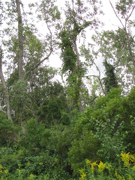
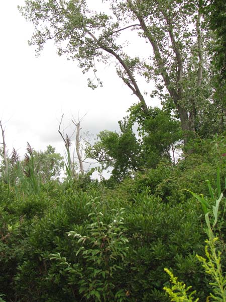
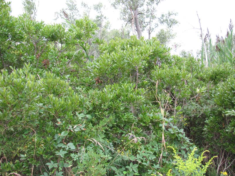
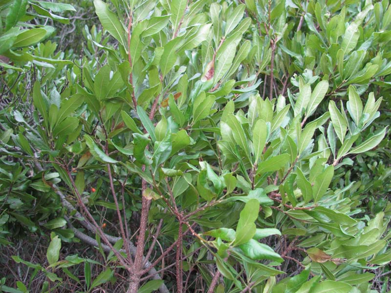
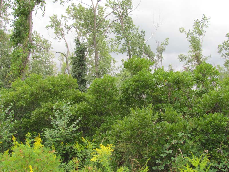
In Pennsylvania, this community type occurs only on Presque Isle, on the shore of Lake Erie. It is found as a zone surrounding swale ponds, slightly higher in elevation than the ponds but lower than the dune ridges. The substrate is sand, and the water table fluctuates seasonally; it is at or near the surface during the spring, and by autumn it falls below the surface but remains accessible to deep-rooted shrubs. The community is dominated by a mixture of bayberry (Myrica pensylvanica), silky dogwood (Cornus amomum), red-osier dogwood (Cornus sericea), Morrow's honeysuckle (Lonicera morrowii), and willows (Salix spp.), with scattered eastern cottonwood (Populus deltoides) and European white birch (Betula pendula). Herbaceous species include bluejoint (Calamagrostis canadensis), sedge (Carex scoparia), Bebb’s sedge (Carex bebbii), blackish wool-grass (Scirpus atrocinctus), Canada goldenrod (Solidago canadensis), sharp-fruited rush (Juncus acuminatus), and southern blue flag (Iris virginica). The community tolerates fluctuation of water levels within a season, due to weather fronts or seasonal variation in precipitation; fluctuations in lake levels over decades may move the community around on the landscape or eliminate it during some years.
This community type is part of the "Great Lakes Region Beach – Dune – Sandplain Complex" (Fike 1999). This complex occurs on a substrate of glacial sand and gravel deposits. This material is constantly being eroded and redeposited by the action of currents, waves, and storm events. The dynamic nature of the substrate maintains a variety of successional stages. Additionally, the porous nature of the substrate causes the water table to respond quickly to changes in lake level. As a result, natural communities occur as a complicated mosaic of different hydrologic conditions, seral stages, physiognomies, and floristic assemblages that shift over time. Great Lakes Region Bayberry – Mixed Shrub Palustrine Shrubland is successional, and may transition to woodland or forest if it does not experience major disturbances.
Rank Justification
Critically imperiled in the jurisdiction because of extreme rarity or because of some factor(s) such as very steep declines making it especially vulnerable to extirpation.
Identification
- Sandy substrate
- Located along Great Lakes shoreline, protected from open water by the leading dune or sand ridge.
- Water levels vary seasonally. Saturated or inundated areas may be visible in spring, or the area may appear dry, especially later in the season, but wetland indicator plant species will be present.
- Vegetation is at least 25% shrubs. Scattered trees may be present, but shrub cover is greater than tree cover.
Shrubs
Herbs
* limited to sites with higher soil calcium
Vascular plant nomenclature follows Rhoads and Block (2007). Bryophyte nomenclature follows Crum and Anderson (1981).
International Vegetation Classification Associations:
USNVC Crosswalk:None
Representative Community Types:None
NatureServe Ecological Systems:
Great Lakes Wooded Dune and Swale (CES201.726)
NatureServe Group Level:
None
Origin of Concept
Fike, J. 1999. Terrestrial and palustrine plant communities of Pennsylvania. Pennsylvania Natural Diversity Inventory. Pennsylvania Department of Conservation and Recreation, Bureau of Forestry, Harrisburg, PA. 86 pp.
Pennsylvania Community Code*
na : Not Available
*(DCNR 1999, Stone 2006)
Similar Ecological Communities
The Great Lakes Region Bayberry – Cottonwood community may be similar, but dry-adapted species predominate instead of wetland indicators. Because of the sandy soils on which both types occur, the wetter type may appear dry for much of the year.
Fike Crosswalk
Great Lakes Region bayberry - mixed shrub palustrine shrubland
Conservation Value
This community is only found along the shores of the Great Lakes. Pennsylvania has a limited extent of shoreline along Lake Erie, and the only remaining examples of this community in Pennsylvania are found at Presque Isle State Park. The lake shore habitat, with its sandy substrate and fluctuating water levels, hosts a substantially different flora and fauna than other Pennsylvania habitats. Because there are no other examples of this habitat within Pennsylvania, there are 77 state rare, threatened, or endangered plant species in Presque Isle communities (Beach 2007). While many plant species found here are common in Ohio, Michigan , and other Midwestern states, some species are specifically adapted to the freshwater shoreline conditions of the Great Lakes and cannot live anywhere else. The lake shore complex also hosts a unique suite of invertebrates such as tiger beetles, spiders, and sand wasps. It is an important refuge for migrating waterbirds and shorebirds. Presque Isle is also used by migrating passerine bird species, which cross the lake at the narrow point between Presque Isle and Long Point on the north shore.
Threats
The invasive exotic species Morrow’s honeysuckle (Lonicera morrowii) is a major threat to the Great Lakes Region Bayberry – Mixed Shrub Palustrine Shrubland. Presque Isle State Park is heavily used for recreation; in some areas overuse damages plant communities.
Management
The addition of engineered structures to the shoreline, such as breakwaters and jetties, has altered the natural erosion and deposition processes that develop the lake shoreline. Shoreline development is part of the long-term physical process that creates the palustrine shrubland habitat behind the leading dune.
Research Needs
Long-term management of Presque Isle could benefit from a better understanding of the natural erosion and deposition processes, as well as how these processes may be affected by artificially created barriers such as breakwaters and jettys.
It is understood that the natural communities of Presque Isle are highly dynamic, affected by movement of the substrate by wind, currents, and storms; and by changes in the water level over seasons and decades. However, there remains much to learn about how these processes affect communities over longer time scales, including the frequency of disturbances, the rate of dune development and movement of communities on the landscape, and the process of succession in plant communities.
Trends
Because the shorelines of the Great Lakes have been extensively developed for industry, recreation, and residences, the extent of natural wetland communities has been greatly diminished. Pennsylvania has limited shoreline area along Lake Erie, and most of it is bluff topography or artificially hardened. Presque Isle State Park is the only remaining area that hosts the bayberry – mixed shrub palustrine shrubland community, and it is unlikely there were other historic examples in Pennsylvania. While the site is protected as a state park, the community may currently be experiencing some declines in quality and extent from invasive species and recreational overuse. The current extent of this community in the larger Great Lakes region is not known, but it is likely limited, as the sand-spit / swale topography found at Presque Isle is somewhat unusual. The percentage of historic wetland area lost in the Great Lakes states is the closest available approximation of trends over time for this community. Wetland loss, measured from pre-settlement times to 1990, has occurred at a higher rate in Great Lakes states (60%) than the national average of 53% (Dahl 1990, Dodge et al. 1994). In recent years, the rate of wetland loss has slowed ((the acreage of wetland area lost between 1998 and 2004 was one-quarter of the acreage that was lost between 1974 and1984), but wetland loss continues to be higher in the Great Lakes region than in other parts of the country (Dahl 2006).
Range Map
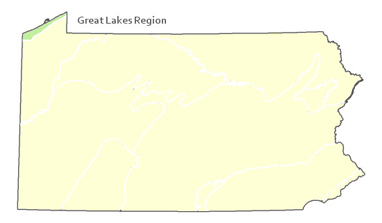
Pennsylvania Range
Great lakes region
Global Distribution
Albert, D. A., and L. Simonson. 2004. Coastal wetland inventory of the Great Lakes region (GIS coverage of entire U.S. Great Lakes: www.glc.org/wtlands/inventory.html), Great Lakes Consortium, Great Lakes Commission, Ann Arbor, MI.
2007. A Legacy of Living Places: conserving the diversity of nature in the Lake Erie Allegheny ecoregion. Ed. David Beach. Lake Erie Allegheny Partnership for Biodiversity: Cleveland, OH.
Albert, D. A. 2004. Between Land and Lake: Michigan’s Great Lake Coastal Wetlands. MSUE bulletin E2902, Michigan Natural Features Inventory, Lansing, MI.
Albert, D. A., Wilcox, D. A., Ingram, J. W., and T. A. Thompson. 2006. Hydrogeomorphic classification for Great Lakes coastal wetlands. Journal of Great Lakes Research. 31 (Suppliment 1): 129-146.
Bissell, J. K., and C. W. Bier. 1987. Presque Isle State Park: Botanical Survey and Natural Community Classification. The Cleveland Museum of Natural History and Western Pennsylvania Conservancy, Pittsburgh, PA.
Dahl, T.E. 1990. Wetland losses in the United States: 1780's to 1980's. U.S. Fish and Wildlife Service, Washington, D.C. 21 pp.
http://www.fws.gov/wetlands/_documents/gSandT/OtherInformation/HistoryWetlandsConterminousUS.pdf
Dahl, T.E. 2006. Status and trends of wetlands in the conterminous United States 1998 to 2004. Washington, DC: U.S. Department of the Interior, Fish and Wildlife Service. http://wetlandsfws.er.usgs.gov/status_trends/index.html
Dodge, D, O. Maple, R. Kavetsky. 1994. Aquatic habitat and wetlands of the Great Lakes. SOLEC 1994 State of the Lakes Ecosystem Conference Background Paper. Environment Canada United States Environmental Protection Agency EPA 905-R-95-014.
Fike, J. 1999. Terrestrial and palustrine plant communities of Pennsylvania. Pennsylvania Natural Diversity Inventory. Pennsylvania Department of Conservation and Recreation. Bureau of Forestry. Harrisburg, PA.
Jennings, O.E. 1907. A botanical survey of Presque Isle, Erie County, Pennsylvania. Annals of the Carnegie Museum 5:289-422.
NatureServe 2010. NatureServe Explorer: An online encyclopedia of life Version 7.1. NatureServe, Arlington, VA. Available http://www.natureserv.org/explorer (accessed: 23 November 2011).
Pennsylvania Department of Conservation and Natural Resources (DCNR). 1999. Inventory Manual of Procedure. For the Fourth State Forest Management Plan. Pennsylvania Bureau of Forestry, Division of Forest Advisory Service. Harrisburg, PA. 51 ppg.
Stone, B., D. Gustafson, and B. Jones. 2006 (revised). Manual of Procedure for State Game Land Cover Typing. Commonwealth of Pennsylvania Game Commission, Bureau of Wildlife Habitat Management, Forest Inventory and Analysis Section, Forestry Division. Harrisburg, PA. 79 ppg.
Cite as:
Mcpherson, J. 2022. Pennsylvania Natural Heritage Program. Great Lakes Bayberry – Mixed Shrub Wetland Factsheet. Available from: https://www.naturalheritage.state.pa.us/Community.aspx?=16034 Date Accessed: June 13, 2026


