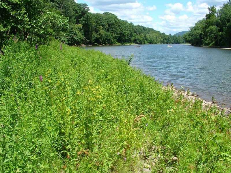
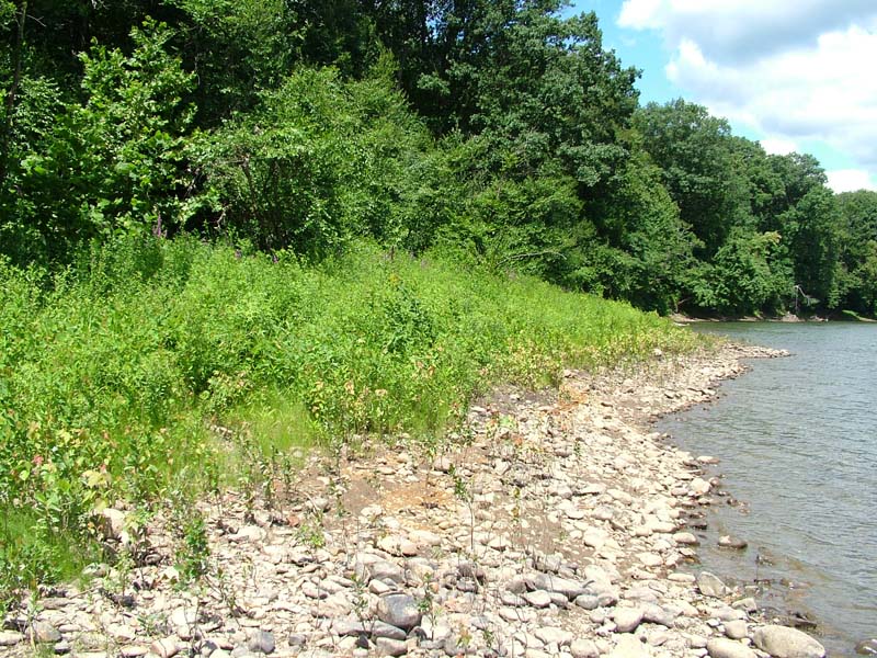
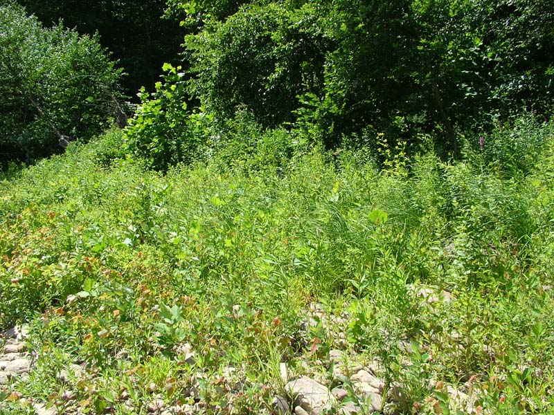
Floodplain Meadow
System: Palustrine
Subsystem: Herbaceous
PA Ecological Group(s):
River Floodplain
Global Rank:GNR
![]() rank interpretation
rank interpretation
State Rank: S4
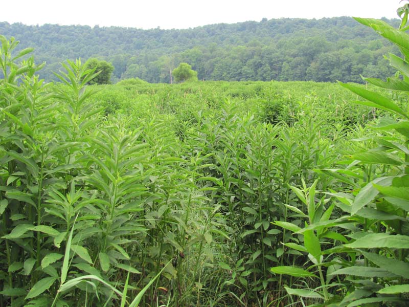
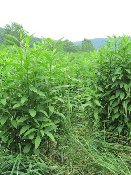
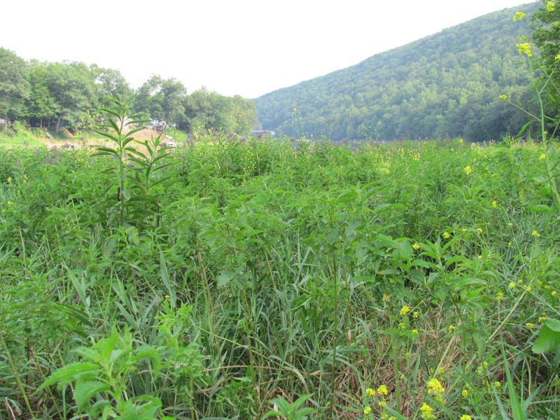
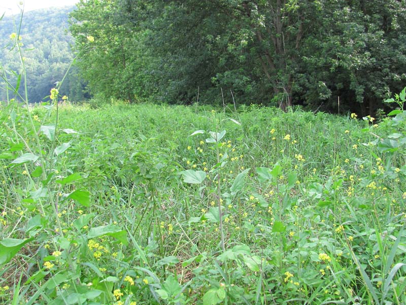
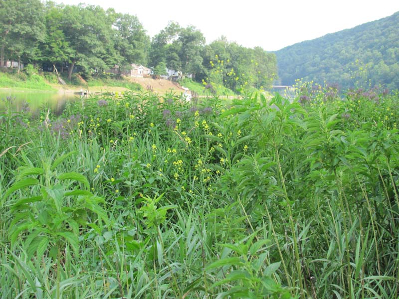
General Description
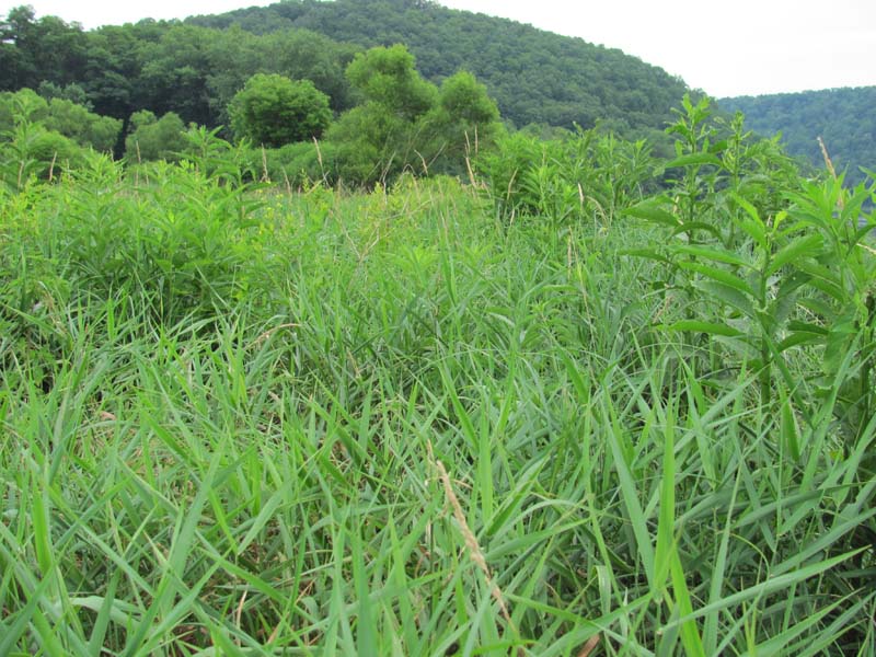
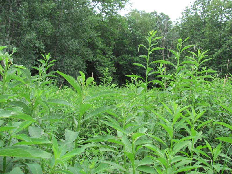
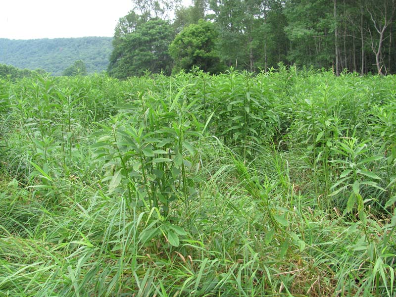
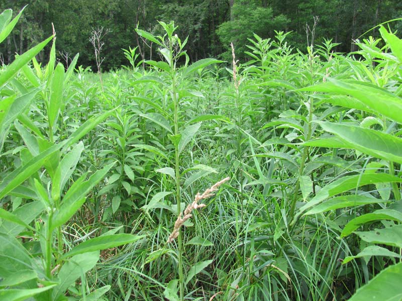
This community is found on levees and low terraces of most medium to large tributaries in all major watersheds of Pennsylvania. It is also found on islands in the stream channel. The substrate is sand, which varies in depth from deep sand deposits to shallow sandy alluvium over cobble. The community typically occurs at or just above the flowing water but may exist at higher elevations on the floodplain. This type is often separated from the flowing water by the Periodically Exposed Shoreline Community; it may also be situated on terraces undercut by flowing water.
The vegetation is characteristically “meadow-like,” composed of a dense herbaceous layer of tall forbs and graminoids. Shrubs, while often present, make up less than 15% of the plant cover. Species include goldenrods (Solidago rugosa, S. canadensis, S. gigantea, Euthamia graminifolia), wingstem (Verbesina alternifolia), reed canary-grass (Phalaris arundinacea), jewelweed (Impatiens capensis), Joe-Pye-weed (Eutrochium fistulosum), spotted Joe-Pye-weed (E. maculatum), boneset (Eupatorium perfoliatum), common sneezeweed (Helenium autumnale), twisted sedge (Carex torta), tussock sedge (C. stricta), cardinal-flower (Lobelia cardinalis), smartweed (Persicaria pensylvanica), blue vervain (Verbena hastata), bulrush (Scirpus polyphyllus), big bluestem (Andropogon gerardii), deer-tongue grass (Dichanthelium clandestinum), muhly (Muhlenbergia spp.), creeping bent (Agrostis stolonifera var. palustris), autumn bent (A. perennans), Virginia cutgrass (Leersia virginica), Indian-hemp (Apocynum cannabinum), beggar-ticks (Bidens spp.), field horsetail (Equisetum arvense), false nettle (Boehmeria cylindrica), bugleweed (Lycopus uniflorus), common yellow wood-sorrel (Oxalis stricta), violets (Viola spp.), wild mint (Mentha arvensis), flat-topped white aster (Doellingeria umbellata), calico aster (Symphyotrichum lateriflorus), marsh pennywort (Hydrocotyle americana), and riverbank wild-rye (Elymus riparius). Scattered short shrubs may be present, including river birch (Betula nigra), diamond willow (Salix eriocephala), and spicebush (Lindera benzoin). Vines, such as riverbank grape (Vitis riparia) and virgin’s-bower (Clematis virginiana) are often found in this type. This type is particularly susceptible to invasion by Japanese knotweeds (Fallopia japonica and F. sachalinense).
Rank Justification
Uncommon but not rare; some cause for long-term concern due to declines or other factors.
Identification
- Dominated by goldenrods (Solidago rugosa, S. canadensis, S. gigantea, Euthamia graminifolia) and wingstem (Verbesina alternifolia)
- Contains a diverse mix of forbs and grasses
- Soils are alluvial and range from deep sand deposits to shallow, sand, and/or gravel over cobble
- Separated from the flowing water by the Periodically Exposed Shoreline
Shrubs
Herbs
- Wrinkle-leaf goldenrod (Solidago rugosa)
- Canada goldenrod (Solidago canadensis)
- Smooth goldenrod (Solidago gigantea)
- Grass-leaved goldenrod (Euthamia graminifolia)
- Wingstem (Verbesina alternifolia)
- Jewelweed (Impatiens capensis)
- Joe-pye-weed (Eutrochium fistulosum)
- Spotted joe-pye-weed (Eutrochium maculatum)
- Boneset (Eupatorium perfoliatum)
- Common sneezeweed (Helenium autumnale)
- Twisted sedge (Carex torta)
- Tussock sedge (Carex stricta)
- Cardinal-flower (Lobelia cardinalis)
- Smartweed (Persicaria pensylvanica)
- Blue vervain (Verbena hastata)
- Bulrush (Scirpus polyphyllus)
- Big bluestem (Andropogon gerardii)
- Deer-tongue grass (Dichanthelium clandestinum)
- Muhly (Muhlenbergia spp.)
- Carpet bentgrass (Agrostis stolonifera var. palustris)
- Autumn bent (Agrostis perennans)
- Cutgrass (Leersia virginica)
- Indian hemp (Apocynum cannabinum)
- Field horsetail (Equisetum arvense)
- False nettle (Boehmeria cylindrica)
- Bugleweed (Lycopus uniflorus)
- Common yellow wood-sorrel (Oxalis stricta)
- Field mint (Mentha arvensis)
- Flat-topped white aster (Doellingeria umbellata)
- Calico aster (Symphyotrichum lateriflorum)
- Marsh pennywort (Hydrocotyle americana)
- Riverbank wild-rye (Elymus riparius)
- Beggar-ticks (Bidens spp.)
- Violets (Viola spp.)
Exotic Species
* limited to sites with higher soil calcium
Vascular plant nomenclature follows Rhoads and Block (2007). Bryophyte nomenclature follows Crum and Anderson (1981).
International Vegetation Classification Associations:
USNVC Crosswalk:None
Representative Community Types:
Piedmont / Central Appalachian Riverbank Tall Herbaceous Vegetation (CEGL006480)
NatureServe Ecological Systems:
Central Appalachian River Floodplain (CES202.608)
NatureServe Group Level:
None
Origin of Concept
Zimmmerman 2008
Pennsylvania Community Code*
HM : Wet Meadow
*(DCNR 1999, Stone 2006)
Similar Ecological Communities
Twisted Sedge (Carex Torta) Stream Margin, Periodically Exposed Shoreline Community, and Big Bluestem – Indian-grass Riverine Grassland can occur adjacent to the Floodplain Meadow Community, but Floodplain Meadow is distinguishable due to the dominance of goldenrod (Solidago spp.) and other forbs as well as the substrate consisting of deeper sandy deposits.
Fike Crosswalk
None. This type is new to the Pennsylvania Plant Community Classification developed from river floodplain classification studies in the Susquehanna and Ohio River Basins.
Conservation Value
This community represents a mixed herbaceous community within the river floodplain complex where a combination of saturated soils, flood scour, ice flow, and often historic farming, land clearing or other human disturbance have resulted in a community type without a strong canopy tree component. These areas serve as vegetated buffers between agricultural land, pastures, or developed areas and thus hold high conservation significance. These communities rarely harbor plant species of conservation concern, tall herbaceous communities on the river floodplain are important breeding, nesting, and foraging areas for bird and insect species.
Threats
Alteration to the frequency and duration of flood events and development of the river floodplains are the two greatest threats to this community statewide and can lead to habitat destruction and/or shifts in community function and dynamics. Non-native invasive plants may be equally devastating as native floodplain plants are displaced. Development of adjacent land can lead to an accumulation of agricultural run-off, pollution, and sedimentation.
In addition, reed canary-grass (Phalaris arundinacea), Japanese knotweed (Fallopia japonica), giant knotweed (F. sachalinense), and purple loosestrife (Lythrum salicaria) may invade this community. Construction of flood-control and navigational dams has resulted in drastic changes to the timing and duration of flood events. These dams have, in some cases, slowed the river flow resulting in deposition of finer sediments favored by the invasive plants.
Management
Direct impacts to the floodplain ecosystems (e.g., road construction, development, filling of wetlands) have greatly altered their composition, structure, and function region-wide. Further impacts that alter riparian function of the remaining areas should therefore be avoided. When development is unavoidable, low impact alternatives (e.g., elevated footpaths, boardwalks, bridges, pervious paving) that maintain floodplain processes should be utilized to minimize impacts to natural areas and the plant and animal species within them. Maintenance of natural buffers surrounding high quality examples of floodplain wetlands is recommended in order to minimize nutrient runoff, pollution, and sedimentation. Care should also be taken to control and prevent the spread of invasive species into high quality sites.
As floodplains are dependent on periodic disturbance, natural flooding frequency and duration should be maintained and construction of new dams, levees, or other in-stream modifications should be avoided. Activities resulting in destabilization of the banks or alteration of the disturbance patterns of the site should be avoided. Numerous land use planning recommendations have been proposed to reduce the negative impacts of changing land use on riparian systems. These include protecting riparian buffer habitat, retaining natural areas in developed landscapes, compensating for lost habitat, excluding livestock grazing from riparian areas, providing corridors between riparian and upland habitats, avoiding constructing roads and utility lines through riparian habitat areas, and restoring degraded riparian habitat. Free-flowing intact riparian systems provide a wide-range of ecological services that are expensive and difficult to replace thru human intervention.
Research Needs
Variations may occur at ecoregional levels. There is need to assess and quantify soils, site hydrology, and other factors to further assess differences between floodplain grasslands on the Ohio, Delaware, and Susquehanna river basins. There is need to monitor high quality examples of this community type.
Trends
There is little to suggest that the occurrence of this type is currently increasing or decreasing. Invasive plants able to tolerate flooded conditions may gain a foothold in these sites and contribute to an overall reduction in quality region-wide. Sites supporting tall herbaceous species near urban areas are most invaded. Wide-spread development of fertile floodplains in the past, particularly for agriculture, may have eliminated suitable habitat for this community.
Range Map
Pennsylvania Range
Statewide
Global Distribution
Kentucky, Maryland, Virginia, and West Virginia
Baker, M.E., and B.V. Barnes. 1998. Landscape ecosystem diversity of river floodplains in northwestern Lower Michigan, U.S.A. Canadian Journal of Forestry Research 28: 1405-1418.
Cowardin, L.M., V. Carter, F.C. Golet, and E.T. La Roe. 1979. Classification of wetlands and deepwater habitats of the United States. U.S. Fish and Wildlife Service. Washington, D.C. 131 pp.
Edinger, Gregory J., D.J. Evans, Shane Gebauer, Timothy G. Howard, David M. Hunt, and Adele M. Olivero. 2002. Ecological Communities of New York State. Second Edition. A revised and expanded edition of Carol Reschke's Ecological Communities of New York State. New York Natural Heritage Program, New York State Department of Environmental Conservation. Albany, NY. 136 pp.
Fike, J. 1999. Terrestrial and palustrine plant communities of Pennsylvania. Pennsylvania Natural Diversity Inventory. Harrisburg, PA. 86 pp.
Gregory, S.V., F.J. Swanson, W.A. McKee, and K.W. Cummins. 1991. An ecosystem perspective of riparian zones. Bioscience 41: 540-551.
NatureServe. 2009. International Ecological Classification Standard: International Vegetation Classification. Central Databases. NatureServe, Arlington, VA. Available http://www.natureserve.org/explorer.
NatureServe. 2009. NatureServe Central Databases. Arlington, Virginia. USA
Pennsylvania Department of Conservation and Natural Resources (DCNR). 1999. Inventory Manual of Procedure. For the Fourth State Forest Management Plan. Pennsylvania Bureau of Forestry, Division of Forest Advisory Service. Harrisburg, PA. 51 ppg.
Pennsylvania Natural Heritage Program. 2004. Classification, Assessment and Protection of Non-Forested Floodplain Wetlands of the Susquehanna Drainage. Report to: The United States Environmental Protection Agency and the Pennsylvania Department of Conservation and Natural Resources, Bureau of Forestry, Ecological Services Section. US EPA Wetlands Protection State Development Grant no. CD-98337501.
Stone, B., D. Gustafson, and B. Jones. 2006 (revised). Manual of Procedure for State Game Land Cover Typing. Commonwealth of Pennsylvania Game Commission, Bureau of Wildlife Habitat Management, Forest Inventory and Analysis Section, Forestry Division. Harrisburg, PA. 79 ppg.
Ward, J.V. 1998. Riverine landscapes: Biodiversity patterns, disturbance regimes, and aquatic conservation. Biological Conservation 83: 269-278.
Zimmerman, E., and G. Podniesinski. 2008. Classification, Assessment and Protection of
Floodplain Wetlands of the Ohio Drainage. Pennsylvania Natural Heritage Program, Western Pennsylvania Conservancy, Pittsburgh, PA. Report to: The United States Environmental Protection Agency and the Pennsylvania Department of Conservation and Natural Resources, Office of Conservation Science. US EPA Wetlands Protection State Development Grant no. CD-973081-01-0.
Cite as:
Zimmerman, E. 2022. Pennsylvania Natural Heritage Program. Floodplain Meadow Factsheet. Available from: https://www.naturalheritage.state.pa.us/Community.aspx?=30020 Date Accessed: July 06, 2026


