Red Maple – Highbush Blueberry Palustrine Woodland
System: Palustrine
Subsystem: Woodland
PA Ecological Group(s): Basin Wetland
Global Rank:GNR
![]() rank interpretation
rank interpretation
State Rank: S5
General Description
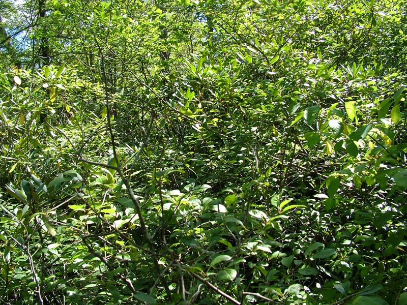
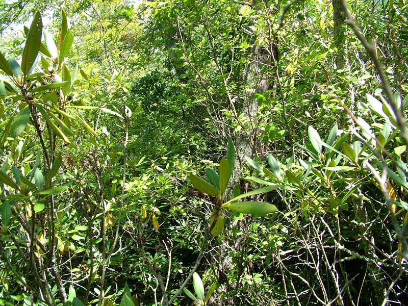
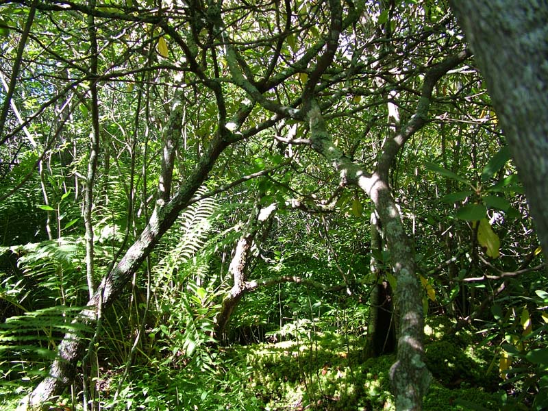
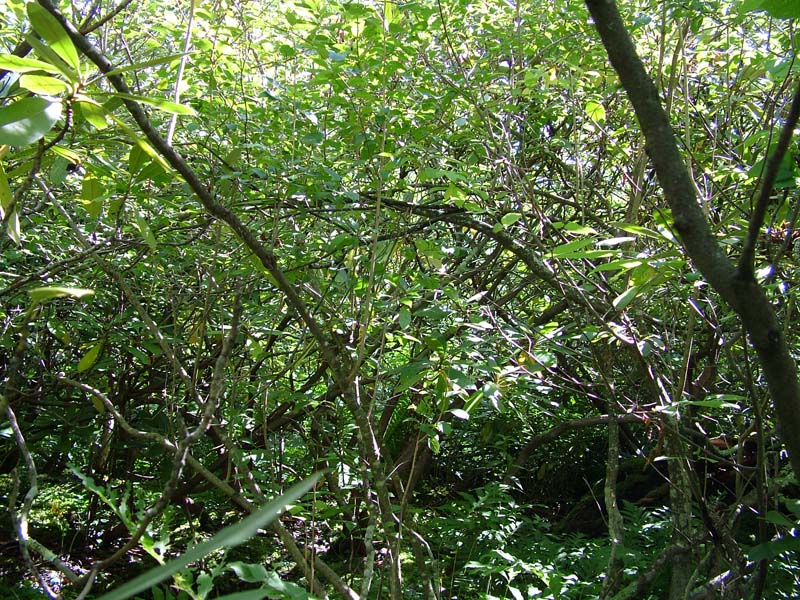
This community type usually occurs on mineral soil often with a layer of muck (occasionally occurs on peat). These woodlands (10-60% tree cover) may occur as isolated pockets in small depressions or as part of larger wetland complexes, and are often associated with past impoundment (beaver or other). This type is most typical of northern and colder portions of the state. Red maple (Acer rubrum), blackgum (Nyssa sylvatica), and gray birch (Betula populifolia) are the most common tree species, although other species may also be present, including eastern white pine (Pinus strobus), pitch pine (Pinus rigida), yellow birch (Betula alleghaniensis), Eastern hemlock (Tsuga canadensis), tamarack (Larix laricina), and red spruce (Picea rubens). The most characteristic shrub species is highbush blueberry (Vaccinium corymbosum). Other shrubs that commonly occur are swamp azalea (Rhododendron viscosum), speckled alder (Alnus incana), red chokeberry (Photinia pyrifolia), maleberry (Lyonia ligustrina), mountain holly (Ilex mucronata), witherod (Viburnum cassinoides), northern arrow-wood (Viburnum recognitum), meadow-sweet (Spiraea latifolia), hardhack (Spiraea tomentosa), elderberry (Sambucus canadensis), and winterberry (Ilex verticillata). Herbaceous species include tussock sedge (Carex stricta) and other sedges (Carex. folliculata, Carex spp.), soft rush (Juncus effusus), mannagrasses (Glyceria spp.), three-way sedge (Dulichium arundinaceum), creeping spike-rush ( Eleocharis palustris), marsh St. John’s-wort (Triadenum virginicum), wool-grass (Scirpus cyperinus), bluejoint (Calamagrostis canadensis), and cinnamon fern (Osmunda cinnamomea).
Rank Justification
Common, widespread, and abundant in the nation or state.
Identification
- Tree cover between 10 and 60%, dominated by red maple (Acer rubrum) and usually less than 30 feet tall
- Shrub layer is extremely dense with shrubs growing on hummocks and is dominated by highbush blueberry (Vaccinium corymbosum)
- Have standing water between the hummocks for most of the year with wapato (Sagittaria latifolia), bur-reed (Sparganium americanum), and other emergent aquatic plants
Shrubs
Herbs
- Tussock sedge (Carex stricta)
- Sedge (Carex folliculata)
- Soft rush (Juncus effusus)
- Cinnamon fern (Osmunda cinnamomea)
- Royal fern (Osmunda regalis)
- Marsh fern (Thelypteris palustris)
- Marsh St. John's-wort (Triadenum virginicum)
- Wool-grass (Scirpus cyperinus)
- Canada bluejoint (Calamagrostis canadensis var. canadensis)
* limited to sites with higher soil calcium
Vascular plant nomenclature follows Rhoads and Block (2007). Bryophyte nomenclature follows Crum and Anderson (1981).
International Vegetation Classification Associations:
USNVC Crosswalk:None
Representative Community Types:
Northern Red Maple Swamp Forest (CEGL006220)
NatureServe Ecological Systems:
North-Central Appalachian Acidic Swamp (CES202.604)
NatureServe Group Level:
None
Origin of Concept
Pennsylvania Community Code*
WH : Red Maple – Highbush Blueberry Palustrine Woodland
*(DCNR 1999, Stone 2006)
Similar Ecological Communities
Red Maple – Highbush Blueberry Palustrine Woodland differs from the Red Maple – Sedge Palustrine Woodland and Red Maple – Mixed shrub Palustrine Woodland in that the dominant shrub species is highbush blueberry (Vaccinium corymbosum). Red Maple – Sedge Palustrine Woodland lacks a definitive shrub layer and is dominated by sedge species in the herb layer. Red Maple – Mixed shrub Palustrine Woodland has a shrub layer dominated by a combination of silky dogwood (Cornus amomum), winterberry (Ilex verticillata), spicebush (Lindera benzoin), smooth alder (Alnus serrulata), silky willow (Salix sericea), swamp rose (Rosa palustris), and/or buttonbush (Cephalanthus occidentalis).
Fike Crosswalk
Red Maple – Highbush Blueberry Palustrine Woodland
Conservation Value
This community serves as nesting habitat for birds such as swamp sparrow (Melospiza georgiana), yellow-rumped warbler (Dendroica coronata), and American goldfinch (Carduelis tristis) as well as foraging habitat for wood ducks (Aix sponsa), black ducks (Anas rubripes), and bat species. This community may serve as habitat for many species of dragonflies and damselflies. This community also serves as a buffer for sediment and pollution runoff from adjacent developed lands by slowing the flow of surficial water causing sediment to settle within this wetland.
Threats
Red Maple – Highbush Blueberry Palustrine Woodlands are threatened by habitat alteration in the watersheds they occupy and nutrient input from surrounding uplands. Clearing and development of adjacent land can lead to an accumulation of run-off, pollution, and sedimentation. Clearing adjacent lands can also lead to wind damage since the trees have shallow root systems. Alterations to the hydrologic regime (beaver dams, road crossings that impede water movement, lowering or raising of water tables) may actually encourage this wetland type. Invasive exotic plant species are a threat when there is nutrient input from surrounding uplands. Species such as common reed (Phragmites australis ssp. australis), purple loosestrife (Lythrum salicaria), and other exotic invasive species can become abundant with increases in nutrients, sediments and other disturbances.
Management
A natural buffer around the wetland should be maintained in order to minimize nutrient runoff, pollution, and sedimentation. The potential for soil erosion based on soil texture, condition of the adjacent vegetation (mature forests vs. clearcuts), and the topography of the surrounding area (i.e., degree of slope) should be considered when establishing buffers. The buffer size should be increased if soils are erodible, adjacent vegetation has been logged, and the topography is steep as such factors could contribute to increased sedimentation and nutrient pollution. Direct impacts and habitat alteration in the wetland should be avoided (e.g., roads, trails, filling of wetlands). Where disturbances are unavoidable, the wetland should be monitored for changes in vegetation, especially invasive species.
Research Needs
Variations may occur at ecoregional levels. There is a need to collect plot data to characterize variations and guide further classification of this community.
Trends
Probably expanding due to beaver population expansion, housing development, and road construction.
Range Map
Pennsylvania Range
Glaciated NE, Glaciated NW, Pocono Plateau, Ridge and Valley
Global Distribution
Connecticut, Delaware, Maine, Massachusetts, New Hampshire, New Jersey, Pennsylvania, Rhode Island, and Vermont
Cowardin, L.M., V. Carter, F.C. Golet, and E.T. La Roe. 1979. Classification of wetlands and deepwater habitats of the United States. U.S. Fish and Wildlife Service. Washington, D.C. 131 pp.
Edinger, G. J., D.J. Evans, S. Gebauer, T. G. Howard, D. M. Hunt, and A. M. Olivero. 2002. Ecological Communities of New York State. Second Edition. A revised and expanded edition of Carol Reschke's Ecological Communities of New York State. New York Natural Heritage Program, New York State Department of Environmental Conservation. Albany, NY. 136 pp.
Fike, J. 1999. Terrestrial and palustrine plant communities of Pennsylvania. Pennsylvania Natural Diversity Inventory. Harrisburg, PA. 79 pp.
Golet, F.C., A.J.K. Calhoun, W.R. DeRagon, D.J. Lowery and A.J. Gold. 1993.Ecology of Red Maple Swamps in th eGlaciated Northeast: a Community Profile. U.S. Dept. of Interior, Fish and Wildlife Service, Washington, D.C.
NatureServe. 2009. NatureServe Central Databases. Arlington, Virginia. USA.
Pennsylvania Department of Conservation and Natural Resources (DCNR). 1999. Inventory Manual of Procedure. For the Fourth State Forest Management Plan. Pennsylvania Bureau of Forestry, Division of Forest Advisory Service. Harrisburg, PA. 51 ppg.
Rhoads, A.F. and T.A. Block. 2007. The Plants of Pennsylvania, 2nd ed. University of Pennsylvania Press.
Rhoads, Ann F. and Timothy A. Block. 2002. Tobyhanna State Park Natural Areas Survey. Report submitted to DCNR, Bureau of State Parks.
Stone, B., D. Gustafson, and B. Jones. 2006 (revised). Manual of Procedure for State Game Land Cover Typing. Commonwealth of Pennsylvania Game Commission, Bureau of Wildlife Habitat Management, Forest Inventory and Analysis Section, Forestry Division. Harrisburg, PA. 79 ppg.
Thompson, E. 1996. Natural communities of Vermont uplands and wetland. Nongame and Natural Heritage Program, Department of Fish and Wildlife in cooperation with The Nature Conservancy, Vermont chapter.
Wenger, S. 1999. A Review of the Scientific Literature on Riparian Buffer Width, Extent and Vegetation. Office of Public Outreach, Institute of Ecology, Univ. of Georgia, Athens.
Cite as:
Davis T. 2022. Pennsylvania Natural Heritage Program. Red Maple – Highbush Blueberry Palustrine Woodland Factsheet. Available from: https://www.naturalheritage.state.pa.us/Community.aspx?=16047 Date Accessed: May 15, 2026


