 Pennsylvania Community Prediction Tool for Site Restoration
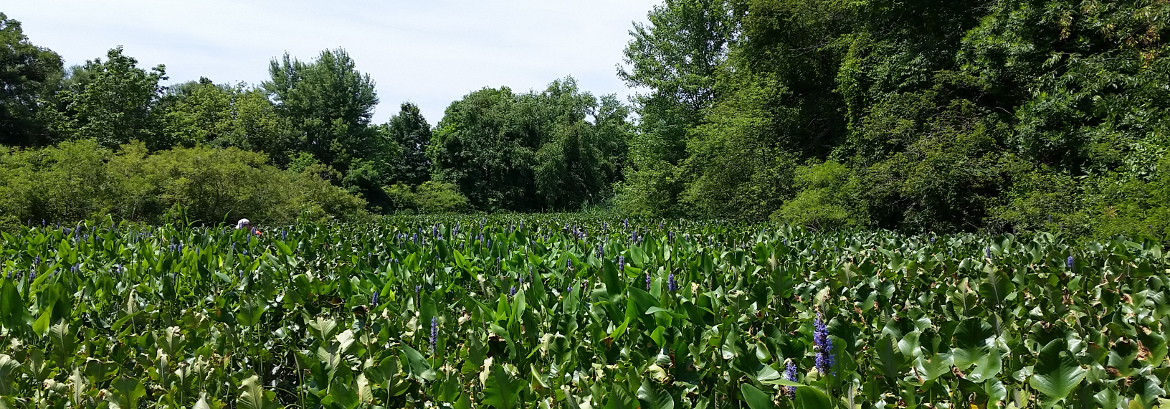
The Pennsylvania Community Prediction Tool for Site Restoration (PCPT) was developed by the PA Natural Heritage Program to assist restoration practitioners in their efforts to establish native plant communities using species most likely to thrive at the site. The PCPT works by comparing site characteristics of your restoration site with ecological site characteristics of known natural vegetation communities sampled by PNHP and partners. Natural communities with similar characteristics are shown in the results and the user can generate a list of suggested species to plant based on common species found in these similar natural communities. Links to the PNHP’s natural community fact sheets are also provided.
How the data in the tool represent your site largely depends on the size and complexity of the site. An assessment site can be any size, but they should be homogenous in terms of the vegetation and site variables. If you have a large heterogeneous site, you can run the tool multiple times to get customized planting lists for each homogenous sub-unit of the site. For example, a 20-acre site might have several different restoration sub-units based on differing slope, aspect, drainage qualities, or soil chemistry.
The PA Prediction Tool is only one piece of the puzzle. It will give you a list of native plants that comprise natural communities likely to thrive on your restoration site, and a little information about each of the species, including its tolerance of human disturbance, wetland status, rarity, and growth habit. It does not tell you which plants are available at local nurseries, easy to grow, resistant to herbivory, or affordable in terms of cost – all critical factors. It does not replace a site visit by an experienced restoration ecologist, who will be able to recognize potential natural regeneration of target species, and also evaluate nearby sources of invasive species. If you are collecting your own seed from local sources (a great strategy to conserve germplasm and local genetics), you will need to work with local nurseries to research seed collection and propagation methods.
Step-By-Step Instructions for Running the Tool
Step 1: Select Location and Obtain Site Variables
The Pennsylvania Community Restoration Planting Prediction Tool works by comparing site characteristics of your restoration site with ecological site characteristics of known natural vegetation communities sampled by PNHP and partners. Through a partnership with NatureServe’s Ecological Monitoring Network, PNHP provides a list of site variables for any location within the Commonwealth that can be automatically compared with the chosen restoration site. These variables are used to generate a list of plant communities that might occur at that location.
Clicking on the Run the tool link opens a web-mapper you will use to identify the location of your restoration site, determine your site variables, and obtain a list of plant communities you will use to guide your restoration efforts.
Using the Select Target button, navigate to a specific site in the web map. When you arrive at your restoration location, click to add a point. This will set your location. Alternatively, you can type or copy in the Latitude and Longitude or address of the site in the “Find address or place” search window. Click on View Report.
| Variable | Description | min | max | mean | stdev | Source |
|---|---|---|---|---|---|---|
| Elevation | Elevation in centimeters (originally in meters) | -110.95 | 1,915.68 | 226.6 | 222.26 | USGS NED |
| Slope | The inclination of slope in degrees. | 0 | 77.49 | 4.8 | 6.12 | USGS NED |
| Slope curvature | The curvature of a cell as fitted through that cell and its neighbors. | -89.81 | 51.44 | 1.75 | 0.35 | USGS NED |
| Profile curvature | The curvature of a cell in the direction of the maximum slope. Affects the acceleration and deceleration of flow and, therefore, influences erosion and deposition | -29.24 | 46.02 | 0.01 | 0.22 | USGS NED |
| Plan curvature | The curvature of a cell perpendicular to the direction of the maximum slope. Influences convergence and divergence of flow | -47.19 | 22.2 | 0.01 | 0.2 | USGS NED |
| Solar radiation summer solstice | Total insolation derived from direct and diffuse, but not reflected, radiation for the summer solstice | 235.97 | 49,006.19 | 25,061.46 | 6,312.49 | USGS NED |
| Solar radiation equinox | Total insolation derived from direct and diffuse, but not reflected, radiation for the equinox | 193.58 | 42,560.51 | 19,682.00 | 5,990.69 | USGS NED |
| Solar radiation winter solstice | Total insolation derived from direct and diffuse, but not reflected, radiation for the winter solstice | 161.69 | 37,711.49 | 16,111.40 | 5,652.38 | USGS NED |
| Roughness 1-cell square | The standard deviation of elevation values within the neighborhood immediately surrounding the center cell. | 0 | 117.51 | 2.2 | 2.81 | USGS NED |
| Roughness 10-cell circle | The standard deviation of elevation values within a circular neighborhood with a radius of 10 cells. | 0 | 162.46 | 9.46 | 11.51 | USGS NED |
| Roughness 100-cell circle | The standard deviation of elevation values within a circular neighborhood with a radius of 100 cells. | 0 | 366.28 | 30.04 | 34.08 | USGS NED |
| Beers aspect | Beers et al. (1966) transformation of slope direction. Original scale is 0 (SW, most exposed) to 2 (NE, most sheltered), with values grading equivalently in both directions between the extremes. | 0 | 2 | 0.99 | 0.48 | USGS NED |
| Dist to inland waters | Euclidean distance to nearest stream, river, or other inland waterbody (excluding estuaries) | 0 | 21,641.00 | 448.17 | 1,175.09 | National Hydrography Dataset; National Land Cover Database; USGS NED |
| Dist to stream | Euclidean distance to nearest stream (features represented by lines only) | 0 | 41,073.42 | 755.17 | 2,288.31 | National Hydrography Dataset; National Land Cover Database; USGS NED |
| Dist to lake or river | Euclidean distance to nearest river or other inland waterbody (features represented by polygons) | 0 | 21,721.37 | 1,021.65 | 1,343.37 | National Hydrography Dataset; National Land Cover Database; USGS NED |
| Dist to coastal waters | Euclidean distance to nearest estuary or sea/ocean. | 0 | 502,430.59 | 144,187.83 | 119,376.10 | National Hydrography Dataset; National Land Cover Database; USGS NED |
| Dist to ocean | Euclidean distance to nearest sea/ocean | 0 | 552,771.13 | 189,327.82 | 139,299.30 | National Hydrography Dataset; National Land Cover Database; USGS NED |
| Dist to estuary | Euclidean distance to nearest estuary | 0 | 502,430.59 | 144,430.69 | 119,114.76 | National Hydrography Dataset; National Land Cover Database; USGS NED |
| Flowpath dist to water or wetland | The downslope distance along the flow path to a water or wetland feature. | EPA/USGS NHD Plus v. 2; NHDH | ||||
| Slope length | The longest upslope distance along the flow path to the top of the drainage divide, plus the downslope distance along the flow path to a water or wetland feature. | EPA/USGS NHD Plus v. 2; NHDH | ||||
| Topographic moisture | Flow accumulation is used as a proxy for topographic moisture. For each cell, this is determined by summing the weights of all cells flowing into it. This does not account for flow differences over different soil types. | EPA/USGS NHD Plus v. 2; NHDH | ||||
| Canopy 1-cell mean | mean percent canopy cover in 1-cell radius (30 meter cells) | 0 | 100 | 54.61206 | 36.6471397 | nlcd_2011_canopy_2011_edition_2014_10_10 |
| Canopy 10-cell mean | mean percent canopy cover in 10-cell radius (30 meter cells) | 0 | 100 | 54.57176 | 30.1648745 | nlcd_2011_canopy_2011_edition_2014_10_10 |
| Canopy 100-cell mean | mean percent canopy cover in 100-cell radius (30 meter cells) | 0 | 100 | 54.18427 | 23.2046566 | nlcd_2011_canopy_2011_edition_2014_10_10 |
| Impervious surface 1-cell mean | mean percent impervious cover in 1-cell radius (30 meter cells) | 0 | 100 | 2.40371 | 9.59022099 | nlcd_2011_impervious_2011_edition_2014_10_10 |
| Impervious surface 10-cell mean | mean percent impervious cover in 10-cell radius (30 meter cells) | 0 | 100 | 2.40081 | 7.82356475 | nlcd_2011_impervious_2011_edition_2014_10_10 |
| Impervious surface 100-cell mean | mean percent impervious cover in 100-cell radius (30 meter cells) | 0 | 100 | 2.37529 | 5.83642793 | nlcd_2011_impervious_2011_edition_2014_10_10 |
| Forest cover 1-cell mean | mean forest cover within 1-cell radius | 0 | 1 | 0.4716 | 0.44439455 | nlcd_2011_landcover_2011_edition_2014_10_10 |
| Forest cover 10-cell mean | mean forest cover within 10-cell radius | 0 | 1 | 0.47128 | 0.35679959 | nlcd_2011_landcover_2011_edition_2014_10_10 |
| Forest cover 100-cell mean | mean forest cover within 100 cell radius | 0 | 1 | 0.46825 | 0.28358335 | nlcd_2011_landcover_2011_edition_2014_10_10 |
| Open cover 1-cell mean | mean open cover within 1-cell radius | 0 | 1 | 0.1915 | 0.34585922 | nlcd_2011_landcover_2011_edition_2014_10_10 |
| Open cover 10-cell mean | mean open cover within 10-cell radius | 0 | 1 | 0.19131 | 0.26085441 | nlcd_2011_landcover_2011_edition_2014_10_10 |
| Open cover 100-cell mean | mean open cover within 100 cell radius | 0 | 1 | 0.18952 | 0.17833686 | nlcd_2011_landcover_2011_edition_2014_10_10 |
| Shrub cover 1-cell mean | mean shrub cover within 1-cell radius | 0 | 1 | 0.0444 | 0.16184661 | nlcd_2011_landcover_2011_edition_2014_10_10 |
| Shrub cover 10-cell mean | mean shrub cover within 10-cell radius | 0 | 1 | 0.04436 | 0.10195784 | nlcd_2011_landcover_2011_edition_2014_10_10 |
| Shrub cover 100-cell mean | mean shrub cover within 100 cell radius | 0 | 1 | 0.04409 | 5.86E-02 | nlcd_2011_landcover_2011_edition_2014_10_10 |
| Water cover 1-cell mean | mean open water cover within 1-cell radius | 0 | 1 | 0.08698 | 0.27548733 | nlcd_2011_landcover_2011_edition_2014_10_10 |
| Water cover 10-cell mean | mean open water cover within 10-cell radius | 0 | 1 | 0.08773 | 0.26299457 | nlcd_2011_landcover_2011_edition_2014_10_10 |
| Water cover 100-cell mean | mean open water cover within 100 cell radius | 0 | 1 | 0.09488 | 0.24713625 | nlcd_2011_landcover_2011_edition_2014_10_10 |
| Wetland cover 1-cell mean | mean wetland cover within 1-cell radius | 0 | 1 | 0.10722 | 0.27614784 | nlcd_2011_landcover_2011_edition_2014_10_10 |
| Wetland cover 10-cell mean | mean wetland cover within 10-cell radius | 0 | 1 | 0.10711 | 0.21481175 | nlcd_2011_landcover_2011_edition_2014_10_10 |
| Wetland cover 100-cell mean | mean wetland cover within 100 cell radius | 0 | 1 | 0.10602 | 0.15670216 | nlcd_2011_landcover_2011_edition_2014_10_10 |
| Dist to woody wetland | Distance to forested palustrine wetland | 0 | 45452.8594 | 1472.17221 | 3061.98508 | National Wetland Inventory |
| Dist to fresh marsh | Distance to freshwater emergent wetland | 0 | 47314.832 | 1894.8842 | 2881.27178 | National Wetland Inventory |
| Dist to salt marsh | Distance to saltwater emergent wetland | 0 | 517641.594 | 156727.356 | 123736.52 | National Wetland Inventory |
| Growing degree days | Growing degree days | 450 | 5928 | 31136.119 | 1214.31 | PRISM_tmax_30yr_normal_800mM2, PRISM_tmin_30yr_normal_800mM2 |
| Dist to sand | Euclidean distance to sand | 0 | ? | ? | ? | soilgeo_comb - dataset from TNC |
| Dist to loam | Euclidean distance to loam | 0 | ? | ? | ? | soilgeo_comb - dataset from TNC |
| Dist to silt/clay | Euclidean distance to silt/clay | 0 | ? | ? | ? | soilgeo_comb - dataset from TNC |
| Dist to CP sand, limestone | Euclidean distance to coastal plain sand over limestone | 0 | ? | ? | ? | soilgeo_comb - dataset from TNC |
| Dist to CP loam, limestone | Euclidean distance to coastal plain loam over limestone | 0 | ? | ? | ? | soilgeo_comb - dataset from TNC |
| Dist to CP silt/clay, limestone | Euclidean distance to coastal plain silt and clay over limestone | 0 | ? | ? | ? | soilgeo_comb - dataset from TNC |
| Dist to acidic sedimentary rock | Euclidean distance to acidic sedimentary bedrock | 0 | ? | ? | ? | soilgeo_comb - dataset from TNC |
| Dist to acidic shale | Euclidean distance to acidic shale bedrock | 0 | ? | ? | ? | soilgeo_comb - dataset from TNC |
| Dist to calc rock | Euclidean distance to calcareous bedrock | 0 | ? | ? | ? | soilgeo_comb - dataset from TNC |
| Dist to moderately calc rock | Euclidean distance to moderately calcareous bedrock | 0 | ? | ? | ? | soilgeo_comb - dataset from TNC |
| Dist to acidic granitic rock | Euclidean distance to acidic granitic bedrock | 0 | ? | ? | ? | soilgeo_comb - dataset from TNC |
| Dist to mafic rock | Euclidean distance to mafic bedrock | 0 | ? | ? | ? | soilgeo_comb - dataset from TNC |
| Dist to ultramafic rock | Euclidean distance to ultramafic bedrock | 0 | ? | ? | ? | soilgeo_comb - dataset from TNC |
| July precip | July precipitation | 6,472.00 | 23,585.00 | 14,726.41 | 4,726.77 | PRISM Climate Data monthly 30yr normal 800m tmin, tmax, ppt |
| June precip | June precipiation | 6,747.00 | 22,378.00 | 13,729.80 | 3,840.05 | PRISM Climate Data monthly 30yr normal 800m tmin, tmax, ppt |
| May precip | May precipitation | 5,112.00 | 19,775.00 | 11,249.89 | 3,369.21 | PRISM Climate Data monthly 30yr normal 800m tmin, tmax, ppt |
| Normalized dispersion of precip | normalized dispersion (CV) of precipitation | 479 | 5,218.00 | 2,873.17 | 1,348.62 | PRISM Climate Data monthly 30yr normal 800m tmin, tmax, ppt |
| Precip of coldest quarter | precipitation of coldest quarter | 11,904.00 | 56,971.00 | 28,103.27 | 8,833.19 | PRISM Climate Data monthly 30yr normal 800m tmin, tmax, ppt |
| Precip of driest month | precipitation of driest month | 3,291.00 | 15,800.00 | 8,086.63 | 2,748.41 | PRISM Climate Data monthly 30yr normal 800m tmin, tmax, ppt |
| Precip of driest quarter | precipitation of driest quarter | 11,780.00 | 49,859.00 | 25,316.62 | 7,412.47 | PRISM Climate Data monthly 30yr normal 800m tmin, tmax, ppt |
| Precip of warmest quarter | precipitation of warmest quarter | 21,343.00 | 69,496.00 | 41,983.15 | 11,896.15 | PRISM Climate Data monthly 30yr normal 800m tmin, tmax, ppt |
| Precip of wettest month | precipitation of wettest month | 7,947.00 | 25,852.00 | 15,879.53 | 4,634.72 | PRISM Climate Data monthly 30yr normal 800m tmin, tmax, ppt |
| Precip of wettest quarter | precipitation of wettest quarter | 22,786.00 | 69,496.00 | 42,729.80 | 11,597.54 | PRISM Climate Data monthly 30yr normal 800m tmin, tmax, ppt |
| Total annual precip | total annual precipitation | 77,842.00 | 243,005.00 | 122,238.78 | 23,827.37 | PRISM Climate Data monthly 30yr normal 800m tmin, tmax, ppt |
| Annual mean temp | annual mean temperature | -199 | 2,114.00 | 1,039.05 | 623.21 | PRISM Climate Data monthly 30yr normal 800m tmin, tmax, ppt |
| Isothermality | comparison of day-to-night and summer-to-winter temperature oscillations | 1,656.00 | 4,825.00 | 3,311.70 | 874.35 | PRISM Climate Data monthly 30yr normal 800m tmin, tmax, ppt |
| Max temp of warmest month | maximum temperature of warmest month | 1,262.00 | 3,434.00 | 2,590.88 | 495.15 | PRISM Climate Data monthly 30yr normal 800m tmin, tmax, ppt |
| Mean diurnal range | (mean of monthly (max temp - min temp)) | 456 | 1,525.00 | 975.61 | 299.94 | PRISM Climate Data monthly 30yr normal 800m tmin, tmax, ppt |
| Mean temp of coldest quarter | mean temperature of coldest quarter | -1,356.00 | 1,405.00 | 48.84 | 782.89 | PRISM Climate Data monthly 30yr normal 800m tmin, tmax, ppt |
| Mean temp of driest quarter | mean temperature of driest quarter | -1,305.00 | 2,407.00 | 591.24 | 1,042.84 | PRISM Climate Data monthly 30yr normal 800m tmin, tmax, ppt |
| Mean temp of warmest quarter | mean temperature of warmest quarter | 935 | 2,793.00 | 1,963.81 | 483.29 | PRISM Climate Data monthly 30yr normal 800m tmin, tmax, ppt |
| Mean temp of wettest quarter | mean temperature of wettest quarter | -532 | 2,784.00 | 1,204.16 | 913.4 | PRISM Climate Data monthly 30yr normal 800m tmin, tmax, ppt |
| Min temp of coldest month | minimum temperature of coldest month | -2,120.00 | 759 | -678 | 829.4 | PRISM Climate Data monthly 30yr normal 800m tmin, tmax, ppt |
| Temp annual range | (max temp warmest month - min temp coldest month) | 2,321.00 | 4,559.00 | 3,446.96 | 640.13 | PRISM Climate Data monthly 30yr normal 800m tmin, tmax, ppt |
| Temp seasonality | (STD * 100) | 54,892.00 | 115,019.00 | 84,798.09 | 17,134.48 | PRISM Climate Data monthly 30yr normal 800m tmin, tmax, ppt |
| Dist to river | Euclidean distance to nearest stream/river | 0 | 40281 | 4946.07 | 4792.29 | National Hydrography Dataset; National Land Cover Database; USGS NED |
| Dist to pond | Euclidean distance to nearest lake/pond/resevoir <= 1 ha | 0 | 36857 | 1456.25 | 2231.65 | National Hydrography Dataset; National Land Cover Database; USGS NED |
| Dist to lake | Euclidean distance to nearest lake/pond/resevoir > 1 ha | 0 | 26765 | 2620.03 | 2672.73 | National Hydrography Dataset; National Land Cover Database; USGS NED |
| Topographic postion index 1-cell square | Topographic position index using elevation values within the neighborhood immediately surrounding the center cell | -179.278 | 107.038 | 6.17 | 0.94 | USGS NED |
| Topographic postion index 10-cell radius | Topographic position index using elevation values within a circular neighborhood with a radius of 10 cells. | -234.269 | 147.295 | 0 | 8.21 | USGS NED |
| Topographic postion index 100-cell radius | Topographic position index using elevation values within a circular neighborhood with a radius of 100 cells. | -483.229 | 573.409 | 0.01 | 36.25 | USGS NED |
| Deciduous forest cover 1-cell mean | mean deciduous forest cover within 1-cell radius | 0 | 100 | 32.15 | 39.93 | nlcd_2011_landcover_2011_edition_2014_10_10 |
| Deciduous forest cover 10-cell mean | mean deciduous forest cover within 10-cell radius | 0 | 100 | 32.14 | 32.59 | nlcd_2011_landcover_2011_edition_2014_10_10 |
| Deciduous forest cover 100-cell mean | mean deciduous forest cover within 100-cell radius | 0 | 100 | 32.14 | 26.7 | nlcd_2011_landcover_2011_edition_2014_10_10 |
| Evergreen forest cover 1-cell mean | mean evergreen forest cover within 1-cell radius | 0 | 100 | 15.5 | 28.9 | nlcd_2011_landcover_2011_edition_2014_10_10 |
| Evergreen forest cover 10-cell mean | mean evergreen forest cover within 10-cell radius | 0 | 100 | 15.5 | 21.04 | nlcd_2011_landcover_2011_edition_2014_10_10 |
| Evergreen forest cover 100-cell mean | mean evergreen forest cover within 100-cell radius | 0 | 98.3 | 15.5 | 14.46 | nlcd_2011_landcover_2011_edition_2014_10_10 |
Clicking the View Report link produces a list of communities likely to occur at the site based on the similarity to quantitative plot data collected by PNHP and assigned to specific plant communities based on species composition, community structure, and environmental variables. If you’re interested in wetland communities or upland communities only, you have the option to limit the results wetlands or uplands by hitting the “View Wetland Targets” or “View Upland Targets”. trial (upland) types as well. You can also see a list of wetland and upland types together by selecting the “View Full List” button.
By selecting the edit button, you can see the values for the 90 environmental variables at your site. You may override the auto-generated values if you have field data that is more precise. Select “Find Wetland Targets” or “Find Upland Targets” to regenerate the list of communities.
Note: after entering site specific data, you will need to select “Find Wetland Targets” or “Find Upland Targets” to regenerate the list of communities.
Step 2: Select the Target Plant Community Targets
The Pennsylvania Community Prediction Tool for Site Restoration will generate a list of upland (terrestrial) or wetland (Palustrine) plant communities that are similar to your site.
Natural plant communities that occur on sites similar to your restoration site are listed in order of their similarity to your site. The results do not include all Pennsylvania Communities. Only communities that are represented by at least 3 plots are included in the PCPT. For example, while PNHP recognizes a community called the Many-Fruited Sedge – Bladderwort Poor Fen, it is known from only one location in the Pocono Mountains of Pennsylvania, and is therefore not represented in the PCPT. Additionally, only plant communities composed of native plant species are included as non-native communities should never be used as targets for restoration plantings.
Step 3: Creating your species list
Once you determine the plant community or communities you want to target in your restoration effort, click the Community to produce the list of plant species occurring in the type. We suggest that you select communities that have at least a 75% similarity in ecological variables to your site. This can be saved as a spreadsheet and/or printed as a csv.
The planting list includes a link to the PNHP fact sheet of the particular natural community that is similar to your restoration site. From there you will find links to the most closely related NatureServe association and ecological system in which the community occurs.
The output includes the following information on each species:
1. Scientific Name: Scientific name in use by PNHP, which generally follows the standards of the Plants of Pennsylvania 2nd Edition (Rhoads and Block 2007).
2. Common Name: The name listed here is the one used by PNHP, but many other common names may be in use and perfectly acceptable.
3. Cover: Cover represents the percent of a plot occupied by the species, when present in the plot(s). We recommend selecting species that are found with a >10% cover.
4. Constancy: Constancy is defined as the number of community plots containing the species divided by the total number of plots used to characterize the community. We recommend selecting species that are found at a >25% constancy.
5. FQI: Floristic Quality Index rating: This rating is based on faithfulness to a natural plant community, and tolerance of and/or dependence on disturbance (particularly human disturbance). The “sweet spot” where your plantings are likely to have the best impact is for plants with FQI values ranging from 4 – 8 https://dep.wv.gov/WWE/getinvolved/Pages/Restoration-Planting-Tool.aspx.
The PA Floristic Quality Index assigned values to species based on the following criteria:
- 0: Exotic or introduced plants.
- 1-2: Native plants with a wide range of ecological tolerances and adapted to severe habitat degradation. These weedy species thrive under conditions of anthropogenic disturbance.
- 3-4: Native plants associated with more stable though degraded habitat, but which may be found in a variety of habitats. They are generally widespread and not an indicator of a particular community type.
- 5-6: Native plants with an intermediate range of ecological tolerances and often associated with a specific natural vegetation community. They include many common dominant species, and can persist under moderate degradation.
- 7-8: Native plants with a narrow range of ecological tolerances, often associated with advanced successional stage, and typically associated with stable natural vegetation communities and natural areas. They can persist where habitat has been slightly degraded.
- 9-10: Native plants with a very high degree of fidelity to a narrow range of pristine habitats, and highly sensitive to anthropogenic disturbance. They are generally restricted to high-quality natural areas.
6. Wetland Code: The wetland tolerance of species should be considered in restoration, especially in wetlands. The National Wetland Inventory (NWI) codes assigned for species in Pennsylvania are
- OBL: Obligate Wetland. Occur almost always (estimated probability >99%) under natural conditions in wetlands.
- FACW: Facultative Wetland. Usually occur in wetlands (estimated probability 67%-99%), but occasionally found in non-wetlands.
- FAC: Facultative. Equally likely to occur in wetlands or non-wetlands (estimated probability 34%-66%).
- FACU: Facultative Upland. Usually occur in non-wetlands (estimated probability 67%-99%), but occasionally found in wetlands (estimated probability 1%-33%).
7. SRank: State Conservation Status Rank. Your restoration site may provide habitat for rare species or may support a rare plant community. We do not recommend planting rare species without careful consideration and coordination with state and federal agencies. The conservation status is provided to help land managers better appreciate the potential habitat value of the site being restored. Rare plant communities are often composed of one or more rare plant species. The state ranks follow NatureServe and can be found here.


