Sugar Maple – Mixed Hardwood Floodplain Forest
System: Palustrine
Subsystem: Forest
PA Ecological Group(s): River Floodplain
Global Rank:GNR
![]() rank interpretation
rank interpretation
State Rank: S4
General Description
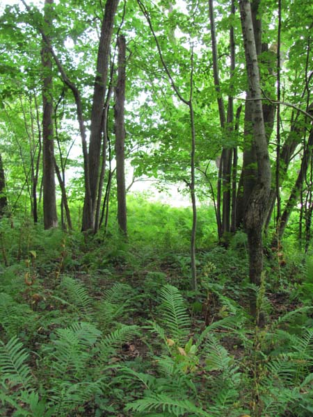
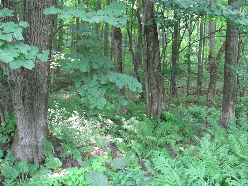
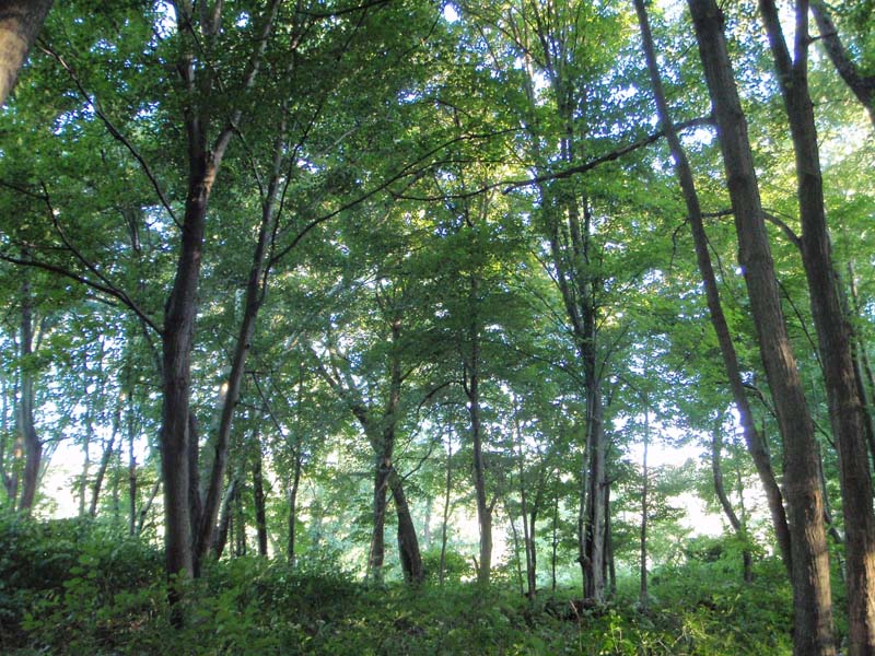
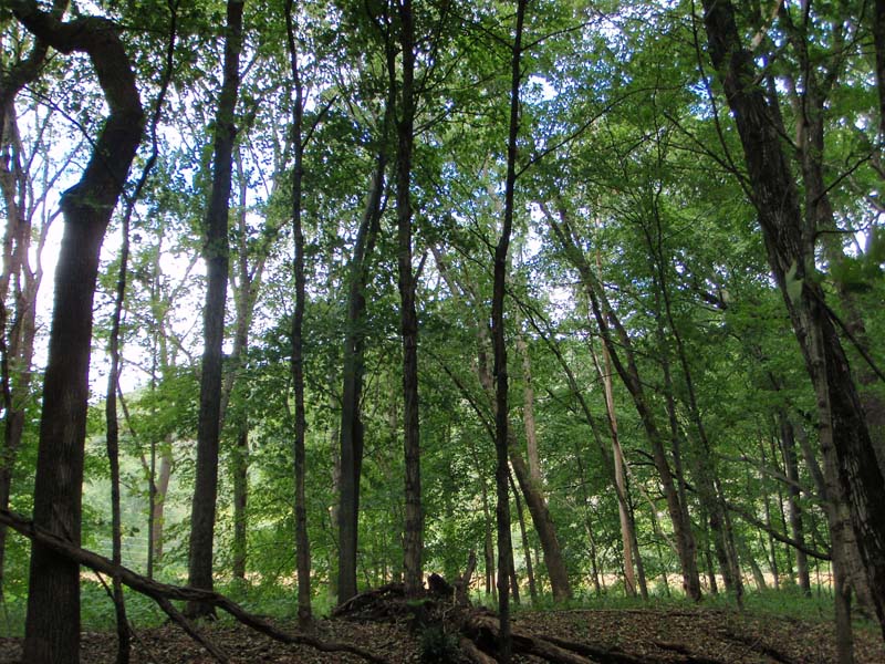
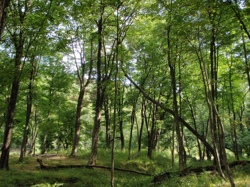
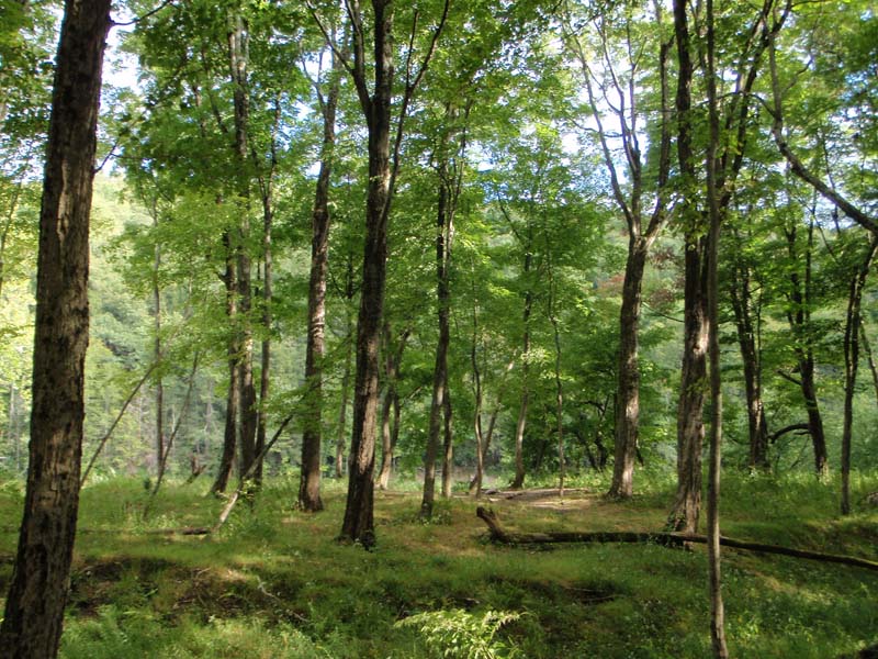
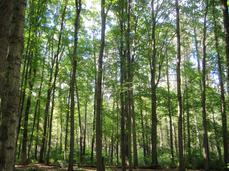
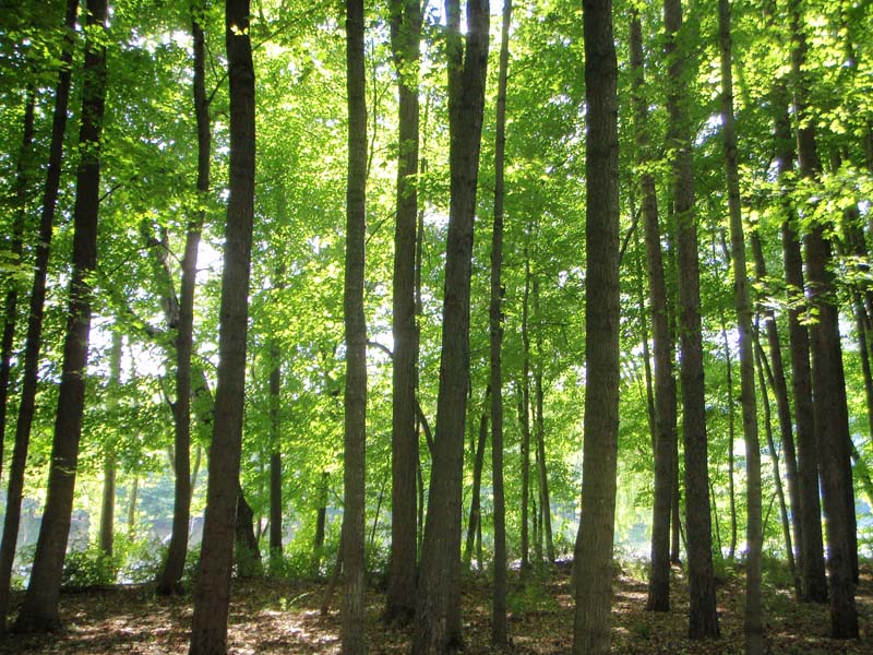
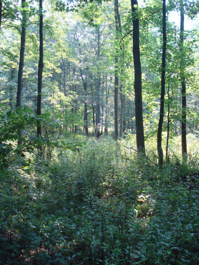
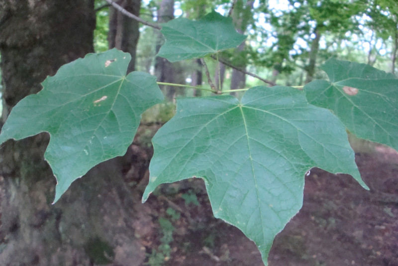
There may be local variations seen in this type due to variation in microtopography within the floodplain. In addition to sugar maple (Acer saccharum) or black maple (Acer nigrum), one of which typically dominates the overstory, the canopy is composed of a diverse mix of associated tree species including basswood (Tilia americana), white ash (Fraxinus americana), green ash (Fraxinus pennsylvanica), bitternut hickory (Carya cordiformis), and American beech (Fagus grandifolia). While usually present, sycamore (Platanus occidentalis) and silver maple (Acer saccharinum) generally do not exceed 25% of the canopy. In flood channels and floodplain depressions, black ash (Fraxinus nigra) and red maple (Acer rubrum) may be present. On more exposed sites, with higher flooding velocities and coarser substrates, this community shares many characteristics with the Sycamore – Mixed hardwood Floodplain Forest and sycamore (Platanus occidentalis) may be a co-dominant. These forests typically have more structural diversity than the Silver Maple Floodplain Forest types, with sugar maple and white ash common in the subcanopy.
Rank Justification
Uncommon but not rare; some cause for long-term concern due to declines or other factors.
Identification
- Found on floodplains of small to medium-sized tributaries of the Ohio River Basin and Delaware River
- Canopy dominated by sugar maple (Acer saccharum) and black maple (Acer nigrum)
- Soils are typically rich, with pH ranging from 6.5 to 8.0
Trees
- Sugar maple (Acer saccharum)
- Black maple (Acer nigrum)
- Basswood (Tilia americana)
- White ash (Fraxinus americana)
- Green ash, red ash (Fraxinus pennsylvanica)
- Bitternut hickory (Carya cordiformis)
- American beech (Fagus grandifolia)
- Sycamore (Platanus occidentalis)
- Silver maple (Acer saccharinum)
- Hornbeam (Carpinus caroliniana)
Shrubs
Herbs
- Clearweed (Pilea pumila)
- Sensitive fern (Onoclea sensibilis)
- Ostrich fern (Matteuccia struthiopteris)
- Jack-in-the-pulpit (Arisaema triphyllum)
- Christmas fern (Polystichum acrostichoides)
- Foamflower (Tiarella cordifolia)
- Wood geranium (Geranium maculatum)
- False nettle (Boehmeria cylindrica)
- Common blue violet (Viola sororia)
- Cream violet (Viola striata)
- White-snakeroot (Ageratina altissima var. altissima)
- Wakerobin (Trillium erectum)
- Toadshade (Trillium sessile)
- Blue-eyed-mary (Collinsia verna)
- Wood-nettle (Laportea canadensis)
- Jumpseed (Persicaria virginiana)
- Skunk cabbage (Symplocarpus foetidus)
- Ramp (Allium tricoccum)
- Blue cohosh (Caulophyllum thalictroides)
- Ostrich fern (Matteuccia struthiopteris)
- Wild-ginger (Asarum canadense)
* limited to sites with higher soil calcium
Vascular plant nomenclature follows Rhoads and Block (2007). Bryophyte nomenclature follows Crum and Anderson (1981).
International Vegetation Classification Associations:
USNVC Crosswalk:None
Representative Community Types:
Terrace Hardwood Floodplain Forest (CEGL006114)
NatureServe Ecological Systems:
Central Appalachian River Floodplain (CES202.608)
NatureServe Group Level:
None
Origin of Concept
Zimmerman, E., and G. Podniesinski. 2008. Classification, Assessment and Protection of Floodplain Wetlands of the Ohio Drainage. Pennsylvania Natural Heritage Program, Western Pennsylvania Conservancy, Pittsburgh, PA. Report to: The United States Environmental Protection Agency and the Pennsylvania Department of Conservation and Natural Resources, Office of Conservation Science. US EPA Wetlands Protection State Development Grant no. CD-973081-01-0.
Fike, J. 1999. Terrestrial and palustrine plant communities of Pennsylvania. Pennsylvania Natural Diversity Inventory. Pennsylvania Department of Conservation and Recreation, Bureau of Forestry, Harrisburg, PA. 86 pp.
Pennsylvania Community Code*
SX : Miscellaneous Palustrine/Floodplain Forest
*(DCNR 1999, Stone 2006)
Similar Ecological Communities
Silver Maple Floodplain Forest are dominated by silver maple and occupy a broader ecological position within the floodplain, whereas the Sugar Maple – Mixed Hardwood Floodplain Forests are limited to rich sites on small to medium size tributaries. In addition to a greater diversity of canopy trees, including white ash (Fraxinus americana) and basswood (Tilia americana), Sugar Maple – Mixed Hardwood Floodplain Forest exhibits a more diverse vernal flora than the Silver Maple Floodplain Forest as nutrients, especially calcium, are more available and sites are more protected from high intensity, long duration spring floods. Sugar Maple – Mixed Hardwood Floodplain Forests typically have more structural diversity than the Silver Maple Floodplain Forest, with small tree and shrubs common in the subcanopy.
Fike Crosswalk
None. This type is new to the Pennsylvania Plant Community Classification developed from river floodplain classification studies in the Ohio River Basin.
Conservation Value
Large contiguous forested floodplains along stretches of free-flowing river are uncommon. Due to the widespread conversion to agriculture and development, large patches of floodplain forest are uncommon in Pennsylvania and hold a high conservation significance. This community may host rare plant species including declined trillium (Trillium flexipes), wild-oat (Chasmanthium latifolium), and purple-rocket (Iodanthus pinnatifidus). This community also serves as a buffer for sediment and pollution runoff from adjacent developed lands by slowing the flow of surficial water causing sediment to settle within this wetland.
Threats
Alteration to the frequency and duration of flood events and development of the river floodplains are the two greatest threats to this community statewide and can lead to habitat destruction and/or shifts in community function and dynamics. Non-native invasive plants may be equally devastating as native floodplain plants are displaced. Development of adjacent land can lead to an accumulation of agricultural run-off, sedimentation, and pollution.
Management
Direct impacts to the floodplain ecosystems (e.g., road construction, development, filling of wetlands) altered their composition, structure, and function region-wide. Further impacts that alter riparian function of the remaining areas should therefore be avoided. When development is unavoidable, low impact alternatives (e.g., elevated footpaths, boardwalks, bridges, pervious paving) that maintain floodplain processes should be utilized to minimize impacts to natural areas and the plant and animal species within them. Maintenance of natural buffers surrounding high quality examples of floodplain wetlands is recommended in order to minimize nutrient runoff, pollution, and sedimentation. Care should also be taken to control and prevent the spread of invasive species into high quality sites.
As floodplains are dependent on periodic disturbance, natural flooding frequency and duration should be maintained and construction of new dams, levees, or other in-stream modifications should be avoided. Activities resulting in destabilization of the banks or alteration of the disturbance patterns of the site should be avoided. Numerous landuse planning recommendations have been proposed to reduce the negative impacts of changing land use on riparian systems. These include protecting riparian buffer habitat, retaining natural areas in developed landscapes, compensating for lost habitat, excluding livestock grazing from riparian areas, providing corridors between riparian and upland habitats, avoiding constructing roads and utility lines through riparian habitat areas, and restoring degraded riparian habitat. Providing the river system some scope to maintain itself may be more cost-effective in the long run than attempts at controlling natural functions through human intervention.
Research Needs
Naturally occurring patches of this type are limited to the Ohio River Basin. While sugar maple dominated forests are often present on floodplains throughout the state, they are often found on sites highly altered by human activity. These may represent remaining, but modified, woodlots between fields, or sites where sugar maple expanded into areas previously dominated by silver maple, sycamore, or other floodplain species following alteration of the natural flooding regime More work needs to be done to determine the origin of the altered sugar maple forest patches across the state and identify characteristics that can be used to differentiate these from the naturally occurring Sugar Maple – Mixed Hardwood Floodplain Forest. Additionally, there is a need to monitor high quality examples of this community type.
Trends
Sugar Maple – Mixed Hardwood Floodplain Forests were undoubtedly more common and have declined due to dam impoundments, human development, and conversion of the rich floodplain sites to agriculture; modification of the adjacent upland has further impacted the quality of this type. Conversion of rich floodplain areas to agriculture probably contributed the most to loss of this type across its range. In addition, as this type is dependent upon nutrient input and disturbance from flowing water, alteration of the natural flooding regime (duration and frequency) also contributed to changes in the composition of this type, as species not able to tolerate periodic inundation were able to gain a foothold. The relative trend for this community is most likely declining slightly due to development; however, new alterations to river hydrology could result in significant changes to this type. High quality examples are most likely declining with invasion of exotic plant species, lack of recruitment due to deer browsing, and lack of periodic flooding events.
Range Map
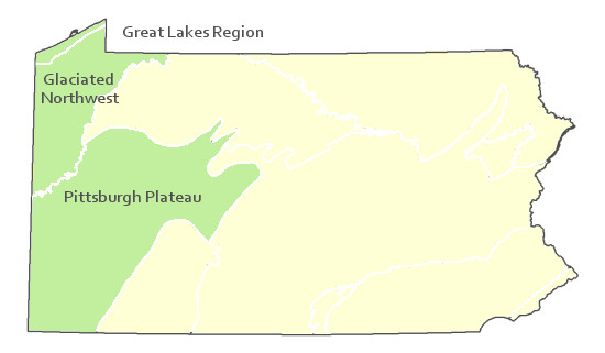
Pennsylvania Range
Glaciated Northwest, Pittsburgh Plateau, and Great Lakes Region
Global Distribution
Connecticut, Maine, Maryland, Massachusetts, New Hampshire, New Jersey, New York, Pennsylvania, and Vermont.
Cowardin, L.M., V. Carter, F.C. Golet, and E.T. La Roe. 1979. Classification of wetlands and deepwater habitats of the United States. U.S. Fish and Wildlife Service. Washington, D.C. 131 pp.
Edinger, Gregory J., D.J. Evans, Shane Gebauer, Timothy G. Howard, David M. Hunt, and Adele M. Olivero. 2002. Ecological Communities of New York State. Second Edition. A revised and expanded edition of Carol Reschke's Ecological Communities of New York State. New York Natural Heritage Program, New York State Department of Environmental Conservation. Albany, NY. 136 pp.
Fike, J. 1999. Terrestrial and palustrine plant communities of Pennsylvania. Pennsylvania Natural Diversity Inventory. Harrisburg, PA. 86 pp.
NatureServe. 2009. NatureServe Central Databases. Arlington, Virginia. USA
Pennsylvania Department of Conservation and Natural Resources (DCNR). 1999. Inventory Manual of Procedure. For the Fourth State Forest Management Plan. Pennsylvania Bureau of Forestry, Division of Forest Advisory Service. Harrisburg, PA. 51 ppg.
Pennsylvania Natural Heritage Program. 2002. Classification, Assessment and Protection of Forested Floodplain Wetlands of the Susquehanna Drainage. Report to: The United States Environmental Protection Agency and the Pennsylvania Department of Conservation and Natural Resources, Bureau of Forestry, Ecological Services Section. US EPA Wetlands Protection State Development Grant no. CD-993731.
Rhoads, Ann F. and Timothy A. Block. 2008. Natural Areas Inventory Update, Montgomery County, Pennsylvania. Montgomery County Planning Commission, Norristown, PA.
Stone, B., D. Gustafson, and B. Jones. 2006 (revised). Manual of Procedure for State Game Land Cover Typing. Commonwealth of Pennsylvania Game Commission, Bureau of Wildlife Habitat Management, Forest Inventory and Analysis Section, Forestry Division. Harrisburg, PA. 79 ppg.
Zimmerman, E., and G. Podniesinski. 2008. Classification, Assessment and Protection of
Floodplain Wetlands of the Ohio Drainage. Pennsylvania Natural Heritage Program, Western Pennsylvania Conservancy, Pittsburgh, PA. Report to: The United States Environmental Protection Agency and the Pennsylvania Department of Conservation and Natural Resources, Office of Conservation Science. US EPA Wetlands Protection State Development Grant no. CD-973081-01-0.
Cite as:
Zimmerman, E. 2022. Pennsylvania Natural Heritage Program. Sugar Maple – Mixed Hardwood Floodplain Forest Factsheet. Available from: https://www.naturalheritage.state.pa.us/Community.aspx?=30017 Date Accessed: July 29, 2026


