Riverbank Freshwater Tidal Marsh
System: Palustrine
Subsystem: Herbaceous
PA Ecological Group(s):
Tidal Wetland and River Floodplain
Global Rank:GNR
![]() rank interpretation
rank interpretation
State Rank: S1
General Description
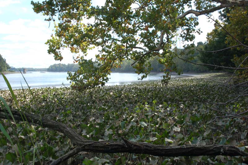
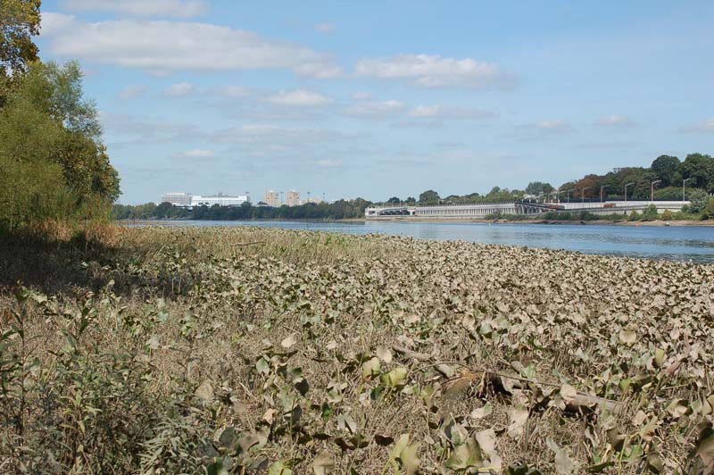
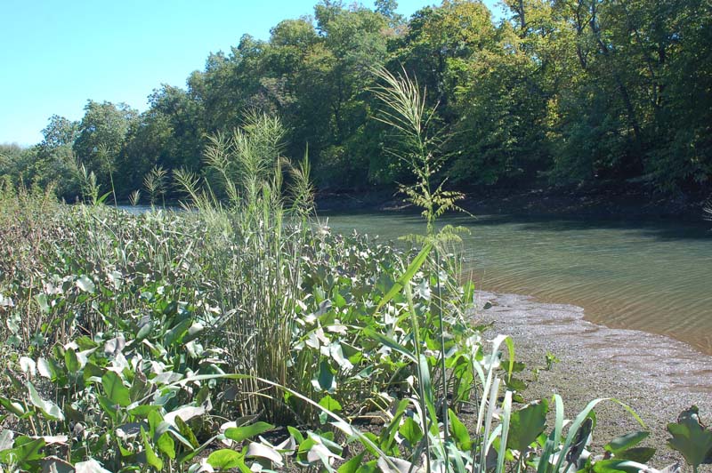
Riverbank Freshwater Tidal Marsh occurs on gradually sloping river banks in the zone between low tide and mean high tide. Tidal amplitude in the Delaware Estuary is approximately 2 meters in vertical height. The width of the intertidal zone on the riverbank depends on the slope of the riverbank.
The riverbank tidal marsh is typically distinctly zoned parallel to the shoreline. The uppermost zone, where the water at high tide is less than 0.5 meter deep, provides habitat for emergent species such as wild-rice (Zizania aquatica), salt-marsh water-hemp (Amaranthus cannabinus), swamp beggar’s-ticks (Bidens bidentoides), showy bur-marigold (Bidens laevis), pickerel-weed (Pontederia cordata), arrow-arum (Peltandra virginica), and water-pepper (Persicaria punctata). These species are also found in the high marsh community. The non-native invasive species common reed (Phragmites australis ssp. australis) and Chinese lobelia (Lobelia chinensis) also occur in this zone.
The middle zone is dominated by threesquare (Schoenoplectus pungens), grading into spatterdock (Nuphar advena). The leaves of spatterdock, which grow singly from horizontal rhizomes up to 3 inches in diameter, form a canopy in the mid-section of the intertidal zone. They are emergent at low tide and below the water surface at high tide. Several of the lower-growing intertidal species grow under the Nuphar canopy including subulate arrowhead (Sagittaria subulata), long-lobed arrowhead (Sagittaria calycina), arrowhead (Sagittaria rigida), mud-plantain (Heteranthera multiflora), and Smith’s bulrush (Schoenoplectus smithii). The non-native invasive umbrella sedge (Cyperus serotinus) also occurs in this zone
The lowest vegetated zone on the intertidal riverbank occurs below the band of spatterdock. It is under as much as two meters of water at high tide and is typically sparsely vegetated. Subulate arrowhead (Sagittaria subulata) is often present. In addition, horned pondweed (Zanichellia palustris), waterweed (Elodea nuttallii), and tape-grass (Vallisneria americana), truly aquatic species, may also be present on the exposed mudflats at low tide.
Rank Justification
Critically imperiled in the jurisdiction because of extreme rarity or because of some factor(s) such as very steep declines making it especially vulnerable to extirpation.
Identification
- Zoned herbaceous vegetation on tidal riverbanks
- Late in the season the wild rice at the upper edge is very conspicuous
- The spatterdock zone in the mid-section is conspicuous except at high tide when it is under water
- At low tide exposed vegetation is often coated with a film of dried mud
- Not visible in the winter, even at low tide
Herbs
Exotic Species
* limited to sites with higher soil calcium
Vascular plant nomenclature follows Rhoads and Block (2007). Bryophyte nomenclature follows Crum and Anderson (1981).
International Vegetation Classification Associations:
USNVC Crosswalk:None
Representative Community Types:
Broadleaf Pond-lily Tidal Marsh (CEGL004472)
Atlantic Coast Wild Rice Tidal Marsh (CEGL004202)
North Atlantic Coastal Plain River Brackish Intertidal Mudflat (CEGL004473)
Atlantic Coast Brackish Tidal Marsh (CEGL004188)
NatureServe Ecological Systems:
Atlantic Coastal Plain Embayed Region Tidal Freshwater Marsh (CES203.259)
NatureServe Group Level:
None
Origin of Concept
Rhoads and Block
Pennsylvania Community Code*
na : Not Available
*(DCNR 1999, Stone 2006)
Similar Ecological Communities
There is overlap in species composition between Riverbank Freshwater Tidal Marsh and Freshwater Tidal Mixed High Marsh. One grades into the other at the level of mean high tide.
Fike Crosswalk
None. This type is new to the Pennsylvania Plant Community Classification developed from inventory studies of Bucks County by Morris Arboretum.
Conservation Value
Riverbank Freshwater Tidal Marsh is a rare community type in Pennsylvania that may have rare plant species including salt-marsh water-hemp (Amaranthus cannabinus), swamp beggar’s-ticks (Bidens bidentoides), small beggar-ticks (Bidens discoidea), showy bur-marigold (Bidens laevis), Walter’s barnyard grass (Echinochloa walteri), American waterwort (Elatine americana), spike-rush (Eleocharis obtusa var. peasii), dwarf spike-rush (Eleocharis parvula), mud-plantain (Heteranthera multiflora), gypsy-wort (Lycopus rubellus), goldenclub (Orontium aquaticum), long-lobed arrowhead (Sagittaria calycina), subulate arrowhead (Sagittaria subulata), river bulrush (Schoenoplectus fluviatilis), Smith’s bulrush (Schoenoplectus smithii), and wild-rice (Zizania aquatica). This community also provides a flood buffer along the Delaware Estuary as well as habitat for fish, birds, and aquatic invertebrates.
Threats
Threats to intertidal marsh communities include sea level rise; conversion to residential, commercial, or industrial uses; water pollution and colonization by non-native invasive species, especially common reed (Phragmites australis ssp. australis), Chinese lobelia (Lobelia chinensis), and umbrella sedge (Cyperus serotinus).
Loss of fine sediments due to erosion from the wakes of commercial ships and pleasure craft is also a major threat to riverbank tidal marsh communities. In several locations the surface layer of fine sediments and its stabilizing algal crust, which together provide a seed bed for intertidal plants, have been washed away leaving the riverbank bare of plants. Many of the intertidal species are annuals (Bidens bidentoides, Sagittaria calycina, Zizania aquatica, Amaranthus cannabinus, Echinochloa walteri) thus their persistence depends on an appropriate seedbed.
Management
There is a need to identify sites where existing land use could allow for inland migration of freshwater tidal marsh communities as sea level rises, and secure theses sites as protected open space. All remaining freshwater tidal marsh communities should be protected from incompatible land use. Opportunities for restoration of freshwater tidal marsh communities should also be pursued.
A natural buffer around the wetland should be maintained in order to minimize nutrient runoff, pollution, and sedimentation. The potential for soil erosion based on soil texture, condition of the adjacent vegetation (mature forests vs. clearcuts), and the topography of the surrounding area (i.e., degree of slope) should be considered when establishing buffers. The buffer size should be increased if soils are erodible, adjacent vegetation has been logged, and the topography is steep as such factors could contribute to increased sedimentation and nutrient pollution. Direct impacts and habitat alteration should be avoided (e.g., roads, trails, filling of wetlands) and low impact alternatives (e.g., elevated footpaths, boardwalks, bridges) should be utilized in situations where accessing the wetland cannot be avoided. Invasive species control should be implemented at sites where common reed (Phragmites australis ssp. australis) is established.
Research Needs
Regular monitoring should be instituted at selected sites.
Trends
Urban development of the Coastal Plain, and hydrological alterations from boat traffic and dredging have greatly decreased the extent of this community type.
Range Map
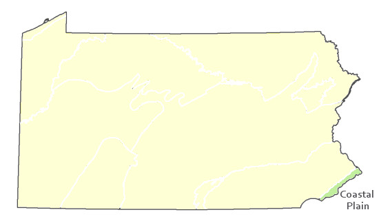
Pennsylvania Range
Coastal Plain
Global Distribution
Connecticut, Delaware, Maine, Maryland, Massachusetts, North Carolina, New Hampshire, New Jersey, New York, Pennsylvania, and Virginia
Ferren, Wayne R. and Alfred E. Schuyler. 1980. Intertidal vascular plants of river systems near Philadelphia. Proceedings of the Academy of Natural Sciences of Philadelphia 132: 86-120.
Fike, J. 1999. Terrestrial and palustrine plant communities of Pennsylvania. Pennsylvania Natural Diversity Inventory. Harrisburg, PA.
NatureServe 2010. NatureServe Explorer: An online encyclopedia of life Version 7.1. NatureServe, Arlington, VA. Available http://www.natureserv.org/explorer (accessed: February 7, 2010).
Pennsylvania Department of Conservation and Natural Resources (DCNR). 1999. Inventory Manual of Procedure. For the Fourth State Forest Management Plan. Pennsylvania Bureau of Forestry, Division of Forest Advisory Service. Harrisburg, PA. 51 ppg.
Schuyler, Alfred E. 1988. Submergent and planmergent flora of the freshwater portion of the Delaware Estuary. Chapter 10 in Ecology and Restoration of the Delaware River Basin, edited by S. K. Majumdar, E. W. Miller, and L. E. Sage. Pennsylvania Academy of Science.
Stone, B., D. Gustafson, and B. Jones. 2006 (revised). Manual of Procedure for State Game Land Cover Typing. Commonwealth of Pennsylvania Game Commission, Bureau of Wildlife Habitat Management, Forest Inventory and Analysis Section, Forestry Division. Harrisburg, PA. 79 ppg.
Titus, J. G., D. E. Hudgens, D. L. Trescott, M. Craghan, W. H. Nuckols, C. H. Hershner, J. M. Kassakian, C. J. Linn, P.G. Merritt, T. M. McCue, J. F. O’Connell, J. Tanski, and J. Wang. 2009. State and local governments plan for the development of most land vulnerable to rising sea level along the U.S Atlantic coast. Environmental Research Letters 4 (doi:10.1088/1748-9326/4/4/044008).
Cite as:
Rhoads and Block 2022. Pennsylvania Natural Heritage Program. Riverbank Freshwater Tidal Marsh Factsheet. Morris Arboretum. Available from: https://www.naturalheritage.state.pa.us/Community.aspx?=30024 Date Accessed: July 26, 2026


